
54 Bus Route Map
View the 54 route map and see all 54 stops along the route. The map of 54 shows where the bus travels and the location of each stop, making it easy to understand the entire route at a glance.
Explore RTC RIDE routes on the map and see where RTC RIDE bus services operate. Use the 54 map to find bus stops and see how the 54 connects different areas along its trip.
All 54 stops on the map are displayed in route order, helping you follow the 54 bus from the first stop to the last.
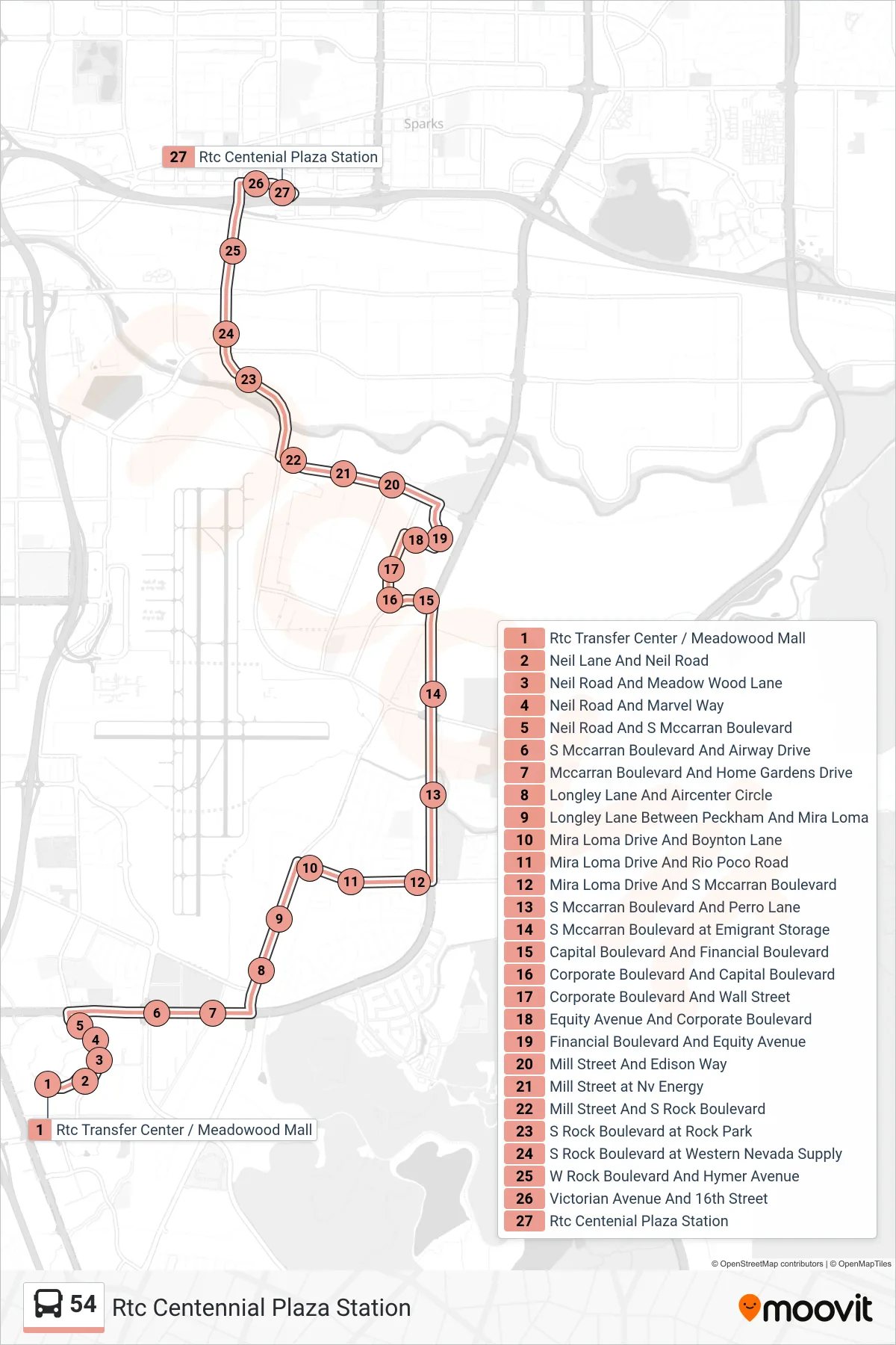
Stops list (54 - Rtc Centennial Plaza Station)
- Rtc Transfer Center / Meadowood Mall
- Neil Lane And Neil Road
- Neil Road And Meadow Wood Lane
- Neil Road And Marvel Way
- Neil Road And S Mccarran Boulevard
- S Mccarran Boulevard And Airway Drive
- Mccarran Boulevard And Home Gardens Drive
- Longley Lane And Aircenter Circle
- Longley Lane Between Peckham And Mira Loma
- Mira Loma Drive And Boynton Lane
- Mira Loma Drive And Rio Poco Road
- Mira Loma Drive And S Mccarran Boulevard
- S Mccarran Boulevard And Perro Lane
- S Mccarran Boulevard at Emigrant Storage
- Capital Boulevard And Financial Boulevard
- Corporate Boulevard And Capital Boulevard
- Corporate Boulevard And Wall Street
- Equity Avenue And Corporate Boulevard
- Financial Boulevard And Equity Avenue
- Mill Street And Edison Way
- Mill Street at Nv Energy
- Mill Street And S Rock Boulevard
- S Rock Boulevard at Rock Park
- S Rock Boulevard at Western Nevada Supply
- W Rock Boulevard And Hymer Avenue
- Victorian Avenue And 16th Street
- Rtc Centenial Plaza Station