
54 Bus Route Map
View the 54 route map and see all 54 stops along the route. The map of 54 shows where the bus travels and the location of each stop, making it easy to understand the entire route at a glance.
Explore AC Transit routes on the map and see where AC Transit bus services operate. Use the 54 map to find bus stops and see how the 54 connects different areas along its trip.
All 54 stops on the map are displayed in route order, helping you follow the 54 bus from the first stop to the last.
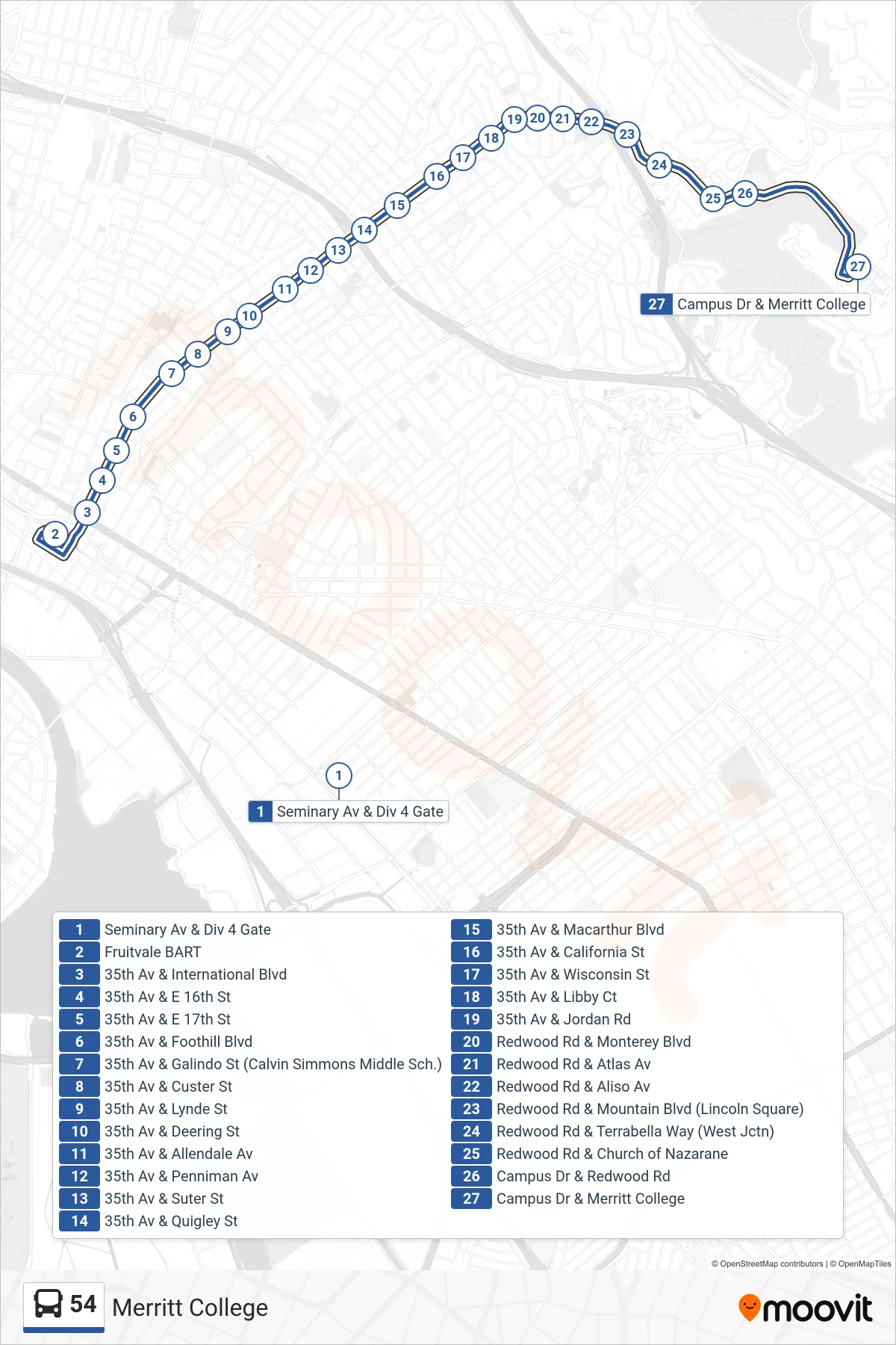
Stops list (54 - Merritt College)
- Seminary Av & Div 4 Gate
- Fruitvale BART
- 35th Av & International Blvd
- 35th Av & E 16th St
- 35th Av & E 17th St
- 35th Av & Foothill Blvd
- 35th Av & Galindo St (Calvin Simmons Middle Sch.)
- 35th Av & Custer St
- 35th Av & Lynde St
- 35th Av & Deering St
- 35th Av & Allendale Av
- 35th Av & Penniman Av
- 35th Av & Suter St
- 35th Av & Quigley St
- 35th Av & Macarthur Blvd
- 35th Av & California St
- 35th Av & Wisconsin St
- 35th Av & Libby Ct
- 35th Av & Jordan Rd
- Redwood Rd & Monterey Blvd
- Redwood Rd & Atlas Av
- Redwood Rd & Aliso Av
- Redwood Rd & Mountain Blvd (Lincoln Square)
- Redwood Rd & Terrabella Way (West Jctn)
- Redwood Rd & Church of Nazarane
- Campus Dr & Redwood Rd
- Campus Dr & Merritt College