
542 Bus Route Map
View the 542 route map and see all 542 stops along the route. The map of 542 shows where the bus travels and the location of each stop, making it easy to understand the entire route at a glance.
Explore DBSch routes on the map and see where DBSch bus services operate. Use the 542 map to find bus stops and see how the 542 connects different areas along its trip.
All 542 stops on the map are displayed in route order, helping you follow the 542 bus from the first stop to the last.
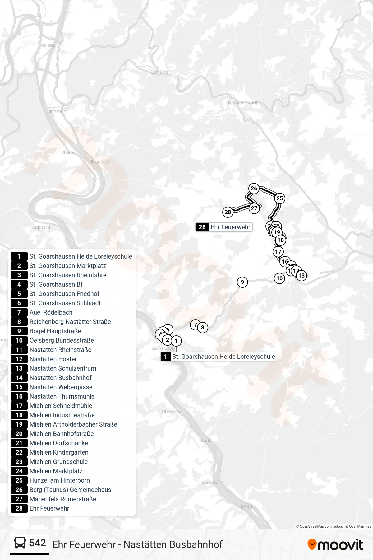
Stops list (542 - Ehr Feuerwehr)
- St. Goarshausen Heide Loreleyschule
- St. Goarshausen Marktplatz
- St. Goarshausen Rheinfähre
- St. Goarshausen Bf
- St. Goarshausen Friedhof
- St. Goarshausen Schlaadt
- Auel Rödelbach
- Reichenberg Nastätter Straße
- Bogel Hauptstraße
- Oelsberg Bundesstraße
- Nastätten Rheinstraße
- Nastätten Hoster
- Nastätten Schulzentrum
- Nastätten Busbahnhof
- Nastätten Webergasse
- Nastätten Thurnsmühle
- Miehlen Schneidmühle
- Miehlen Industriestraße
- Miehlen Aftholderbacher Straße
- Miehlen Bahnhofstraße
- Miehlen Dorfschänke
- Miehlen Kindergarten
- Miehlen Grundschule
- Miehlen Marktplatz
- Hunzel am Hinterborn
- Berg (Taunus) Gemeindehaus
- Marienfels Römerstraße
- Ehr Feuerwehr