
549 Bus Route Map
View the 549 route map and see all 549 stops along the route. The map of 549 shows where the bus travels and the location of each stop, making it easy to understand the entire route at a glance.
Explore PACE routes on the map and see where PACE bus services operate. Use the 549 map to find bus stops and see how the 549 connects different areas along its trip.
All 549 stops on the map are displayed in route order, helping you follow the 549 bus from the first stop to the last.
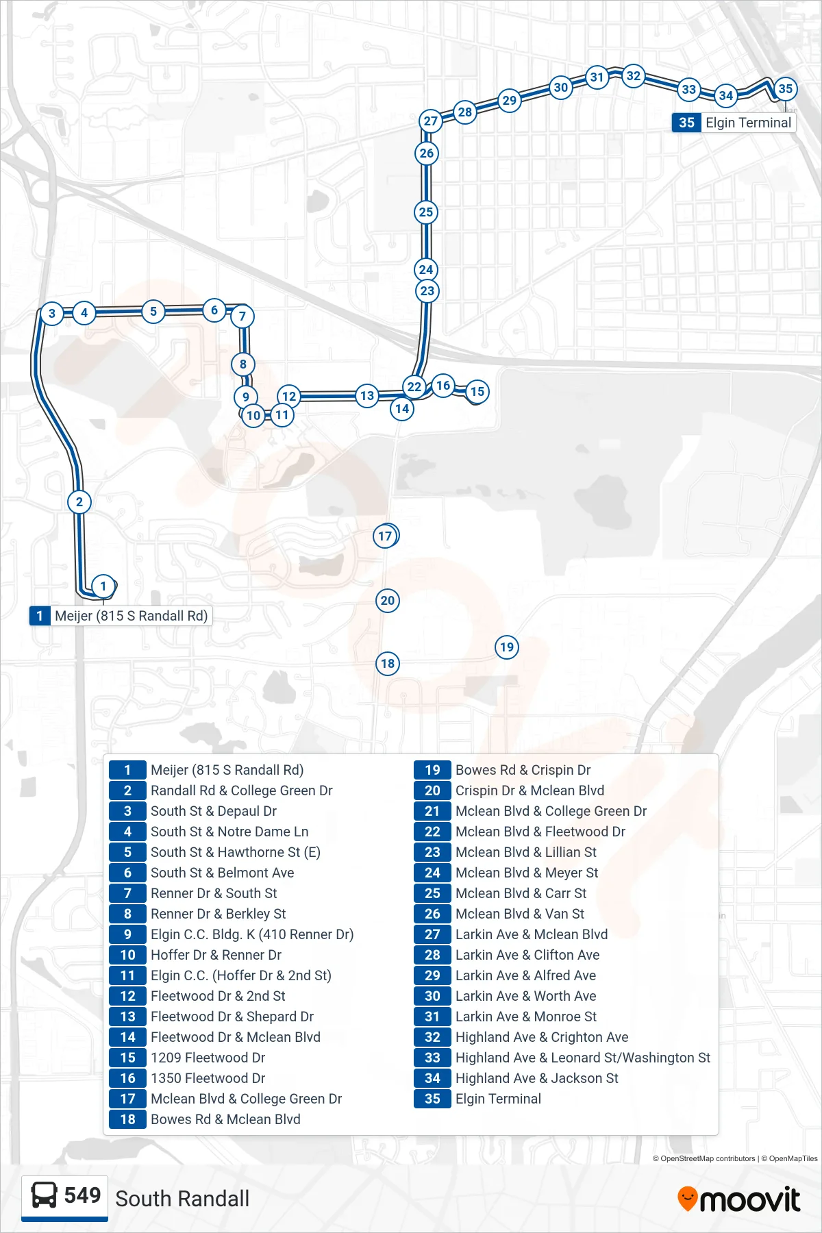
Stops list (549 - Elgin Transportation Center - Bus Stop C)
- Meijer (815 S Randall Rd)
- Randall Rd & College Green Dr
- South St & Depaul Dr
- South St & Notre Dame Ln
- South St & Hawthorne St (E)
- South St & Belmont Ave
- Renner Dr & South St
- Renner Dr & Berkley St
- Elgin C.C. Bldg. K (410 Renner Dr)
- Hoffer Dr & Renner Dr
- Elgin C.C. (Hoffer Dr & 2nd St)
- Fleetwood Dr & 2nd St
- Fleetwood Dr & Shepard Dr
- Fleetwood Dr & Mclean Blvd
- 1209 Fleetwood Dr
- 1350 Fleetwood Dr
- Mclean Blvd & College Green Dr
- Bowes Rd & Mclean Blvd
- Bowes Rd & Crispin Dr
- Crispin Dr & Mclean Blvd
- Mclean Blvd & College Green Dr
- Mclean Blvd & Fleetwood Dr
- Mclean Blvd & Lillian St
- Mclean Blvd & Meyer St
- Mclean Blvd & Carr St
- Mclean Blvd & Van St
- Larkin Ave & Mclean Blvd
- Larkin Ave & Clifton Ave
- Larkin Ave & Alfred Ave
- Larkin Ave & Worth Ave
- Larkin Ave & Monroe St
- Highland Ave & Crighton Ave
- Highland Ave & Leonard St/Washington St
- Highland Ave & Jackson St
- Elgin Terminal