
55 Bus Route Map
View the 55 route map and see all 55 stops along the route. The map of 55 shows where the bus travels and the location of each stop, making it easy to understand the entire route at a glance.
Explore Rhode Island Public Transit Authority routes on the map and see where Rhode Island Public Transit Authority bus services operate. Use the 55 map to find bus stops and see how the 55 connects different areas along its trip.
All 55 stops on the map are displayed in route order, helping you follow the 55 bus from the first stop to the last.
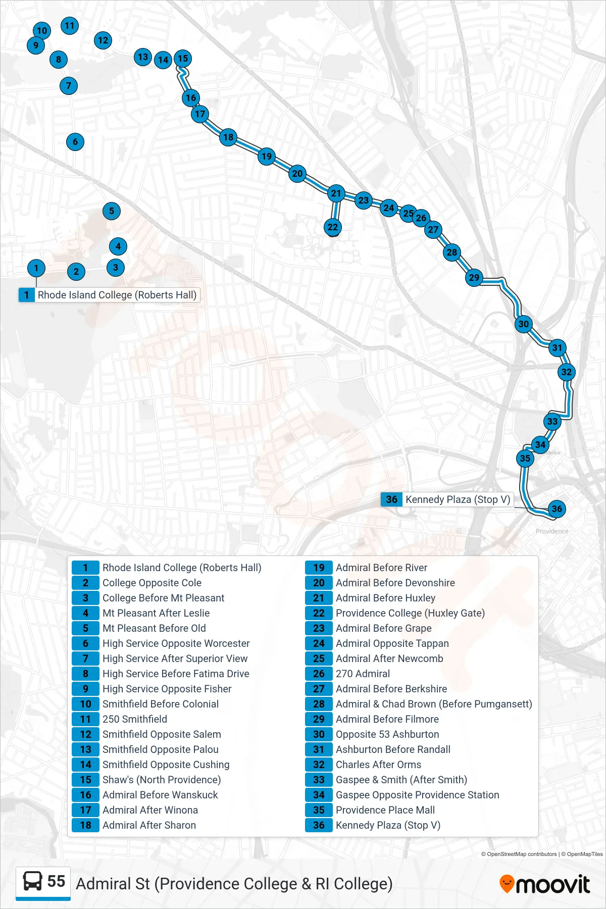
Stops list (55 - Kennedy Plaza)
- Rhode Island College (Roberts Hall)
- College Opposite Cole
- College Before Mt Pleasant
- Mt Pleasant After Leslie
- Mt Pleasant Before Old
- High Service Opposite Worcester
- High Service After Superior View
- High Service Before Fatima Drive
- High Service Opposite Fisher
- Smithfield Before Colonial
- 250 Smithfield
- Smithfield Opposite Salem
- Smithfield Opposite Palou
- Smithfield Opposite Cushing
- Shaw's (North Providence)
- Admiral Before Wanskuck
- Admiral After Winona
- Admiral After Sharon
- Admiral Before River
- Admiral Before Devonshire
- Admiral Before Huxley
- Providence College (Huxley Gate)
- Admiral Before Grape
- Admiral Opposite Tappan
- Admiral After Newcomb
- 270 Admiral
- Admiral Before Berkshire
- Admiral & Chad Brown (Before Pumgansett)
- Admiral Before Filmore
- Opposite 53 Ashburton
- Ashburton Before Randall
- Charles After Orms
- Gaspee & Smith (After Smith)
- Gaspee Opposite Providence Station
- Providence Place Mall
- Kennedy Plaza (Stop V)