
55 Bus Route Map
View the 55 route map and see all 55 stops along the route. The map of 55 shows where the bus travels and the location of each stop, making it easy to understand the entire route at a glance.
Explore Süd Weil am Rhein Lörrach routes on the map and see where Süd Weil am Rhein Lörrach bus services operate. Use the 55 map to find bus stops and see how the 55 connects different areas along its trip.
All 55 stops on the map are displayed in route order, helping you follow the 55 bus from the first stop to the last.
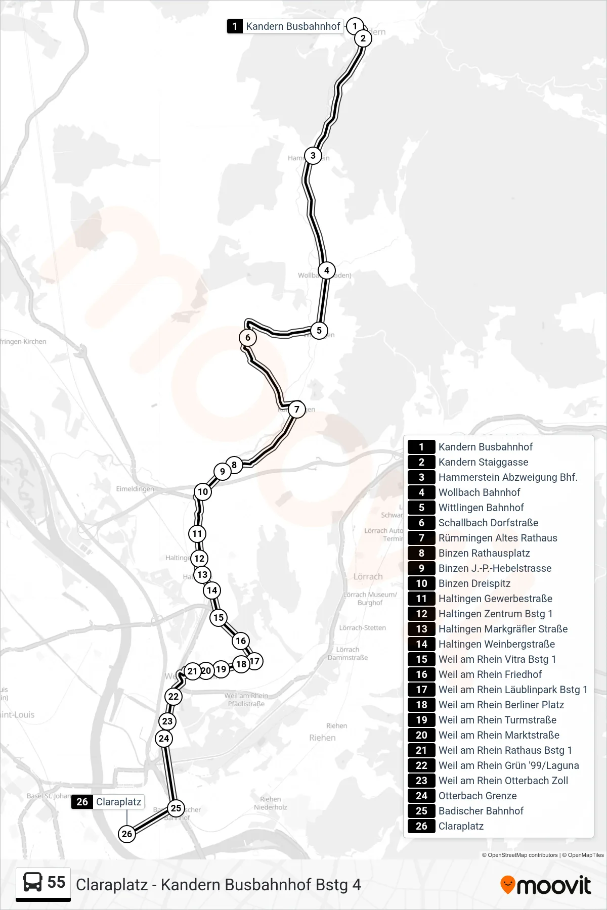
Stops list (55 - Claraplatz)
- Kandern Busbahnhof
- Kandern Staiggasse
- Hammerstein Abzweigung Bhf.
- Wollbach Bahnhof
- Wittlingen Bahnhof
- Schallbach Dorfstraße
- Rümmingen Altes Rathaus
- Binzen Rathausplatz
- Binzen J.-P.-Hebelstrasse
- Binzen Dreispitz
- Haltingen Gewerbestraße
- Haltingen Zentrum Bstg 1
- Haltingen Markgräfler Straße
- Haltingen Weinbergstraße
- Weil am Rhein Vitra Bstg 1
- Weil am Rhein Friedhof
- Weil am Rhein Läublinpark Bstg 1
- Weil am Rhein Berliner Platz
- Weil am Rhein Turmstraße
- Weil am Rhein Marktstraße
- Weil am Rhein Rathaus Bstg 1
- Weil am Rhein Grün '99/Laguna
- Weil am Rhein Otterbach Zoll
- Otterbach Grenze
- Badischer Bahnhof
- Claraplatz