
55 Bus Route Map
View the 55 route map and see all 55 stops along the route. The map of 55 shows where the bus travels and the location of each stop, making it easy to understand the entire route at a glance.
Explore RÖHLER Touristik GmbH routes on the map and see where RÖHLER Touristik GmbH bus services operate. Use the 55 map to find bus stops and see how the 55 connects different areas along its trip.
All 55 stops on the map are displayed in route order, helping you follow the 55 bus from the first stop to the last.
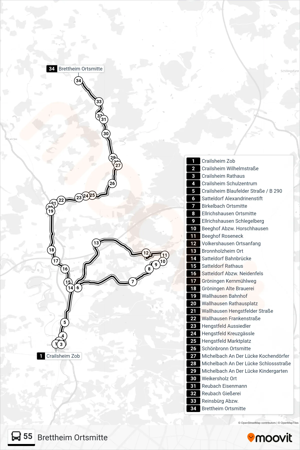
Stops list (55 - Brettheim Ortsmitte)
- Crailsheim Zob
- Crailsheim Wilhelmstraße
- Crailsheim Rathaus
- Crailsheim Schulzentrum
- Crailsheim Blaufelder Straße / B 290
- Satteldorf Alexandrinenstift
- Birkelbach Ortsmitte
- Ellrichshausen Ortsmitte
- Ellrichshausen Schlegelberg
- Beeghof Abzw. Horschhausen
- Beeghof Roseneck
- Volkershausen Ortsanfang
- Bronnholzheim Ort
- Satteldorf Bahnbrücke
- Satteldorf Rathaus
- Satteldorf Abzw. Neidenfels
- Gröningen Kernmühlweg
- Gröningen Alte Brauerei
- Wallhausen Bahnhof
- Wallhausen Rathausplatz
- Wallhausen Hengstfelder Straße
- Wallhausen Frankenstraße
- Hengstfeld Aussiedler
- Hengstfeld Kreuzgässle
- Hengstfeld Marktplatz
- Schönbronn Ortsmitte
- Michelbach An Der Lücke Kochendörfer
- Michelbach An Der Lücke Schlossstraße
- Michelbach An Der Lücke Kindergarten
- Weikersholz Ort
- Reubach Eisenmann
- Reubach Gießerei
- Reinsbürg Abzw.
- Brettheim Ortsmitte
Change direction
- Route Map - 55 - Roßfeld Hofwiesen
- Route Map - 55 - Crailsheim Zob
- Route Map - 55 - Gröningen Alte Brauerei
- Route Map - 55 - Gröningen Schule
- Route Map - 55 - Michelbach An Der Lücke Schlossstraße
- Route Map - 55 - Crailsheim Leonhard-Sachs-Schule
- Route Map - 55 - Hilgartshausen Ortsmitte
- Route Map - 55 - Satteldorf Rathaus
- Route Map - 55 - Bölgental Ort
- Route Map - 55 - Brettheim Arzt
- Route Map - 55 - Wallhausen Rathausplatz