
55 Bus Route Map
View the 55 route map and see all 55 stops along the route. The map of 55 shows where the bus travels and the location of each stop, making it easy to understand the entire route at a glance.
Explore Arlington Transit (ART) routes on the map and see where Arlington Transit (ART) bus services operate. Use the 55 map to find bus stops and see how the 55 connects different areas along its trip.
All 55 stops on the map are displayed in route order, helping you follow the 55 bus from the first stop to the last.
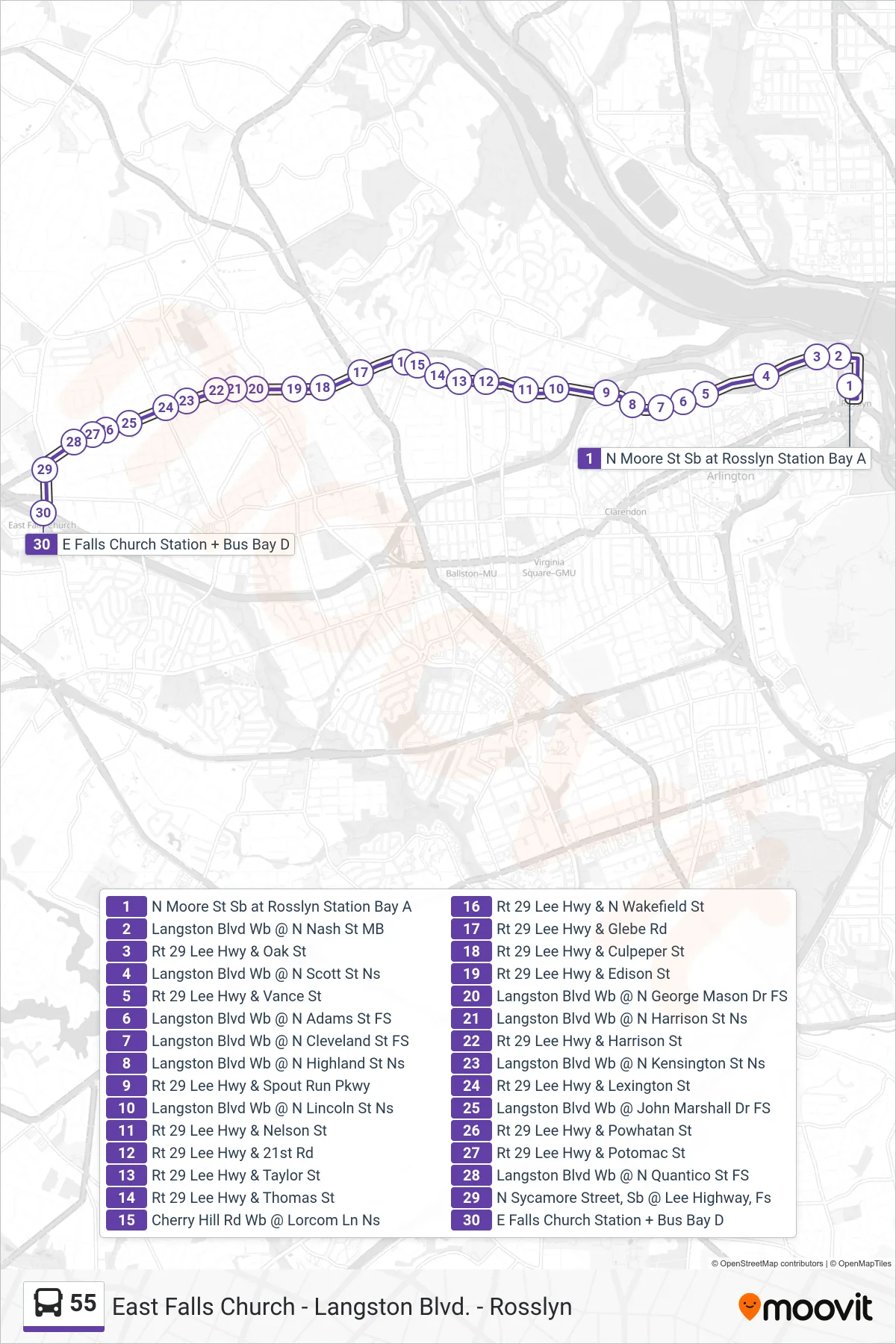
Stops list (55 - East Falls Church)
- N Moore St Sb at Rosslyn Station Bay A
- Langston Blvd Wb @ N Nash St MB
- Rt 29 Lee Hwy & Oak St
- Langston Blvd Wb @ N Scott St Ns
- Rt 29 Lee Hwy & Vance St
- Langston Blvd Wb @ N Adams St FS
- Langston Blvd Wb @ N Cleveland St FS
- Langston Blvd Wb @ N Highland St Ns
- Rt 29 Lee Hwy & Spout Run Pkwy
- Langston Blvd Wb @ N Lincoln St Ns
- Rt 29 Lee Hwy & Nelson St
- Rt 29 Lee Hwy & 21st Rd
- Rt 29 Lee Hwy & Taylor St
- Rt 29 Lee Hwy & Thomas St
- Cherry Hill Rd Wb @ Lorcom Ln Ns
- Rt 29 Lee Hwy & N Wakefield St
- Rt 29 Lee Hwy & Glebe Rd
- Rt 29 Lee Hwy & Culpeper St
- Rt 29 Lee Hwy & Edison St
- Langston Blvd Wb @ N George Mason Dr FS
- Langston Blvd Wb @ N Harrison St Ns
- Rt 29 Lee Hwy & Harrison St
- Langston Blvd Wb @ N Kensington St Ns
- Rt 29 Lee Hwy & Lexington St
- Langston Blvd Wb @ John Marshall Dr FS
- Rt 29 Lee Hwy & Powhatan St
- Rt 29 Lee Hwy & Potomac St
- Langston Blvd Wb @ N Quantico St FS
- N Sycamore Street, Sb @ Lee Highway, Fs
- E Falls Church Station + Bus Bay D