
550 Bus Route Map
View the 550 route map and see all 550 stops along the route. The map of 550 shows where the bus travels and the location of each stop, making it easy to understand the entire route at a glance.
Explore Verkehrsverbund Elbe Elster routes on the map and see where Verkehrsverbund Elbe Elster bus services operate. Use the 550 map to find bus stops and see how the 550 connects different areas along its trip.
All 550 stops on the map are displayed in route order, helping you follow the 550 bus from the first stop to the last.
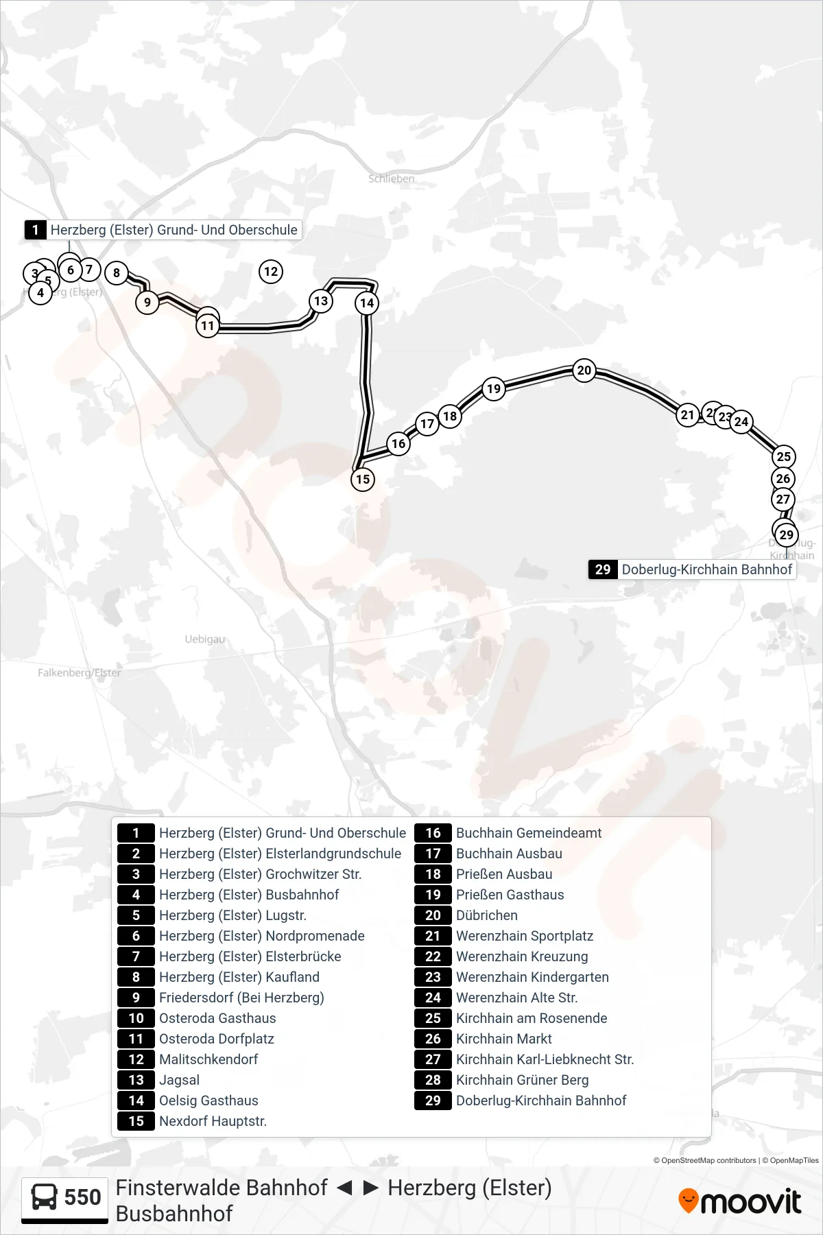
Stops list (550 - Doberlug-Kirchhain Bahnhof)
- Herzberg (Elster) Grund- Und Oberschule
- Herzberg (Elster) Elsterlandgrundschule
- Herzberg (Elster) Grochwitzer Str.
- Herzberg (Elster) Busbahnhof
- Herzberg (Elster) Lugstr.
- Herzberg (Elster) Nordpromenade
- Herzberg (Elster) Elsterbrücke
- Herzberg (Elster) Kaufland
- Friedersdorf (Bei Herzberg)
- Osteroda Gasthaus
- Osteroda Dorfplatz
- Malitschkendorf
- Jagsal
- Oelsig Gasthaus
- Nexdorf Hauptstr.
- Buchhain Gemeindeamt
- Buchhain Ausbau
- Prießen Ausbau
- Prießen Gasthaus
- Dübrichen
- Werenzhain Sportplatz
- Werenzhain Kreuzung
- Werenzhain Kindergarten
- Werenzhain Alte Str.
- Kirchhain am Rosenende
- Kirchhain Markt
- Kirchhain Karl-Liebknecht Str.
- Kirchhain Grüner Berg
- Doberlug-Kirchhain Bahnhof
Change direction
- Route Map - 550 - Herzberg (Elster) Busbahnhof
- Route Map - 550 - Finsterwalde Bahnhof
- Route Map - 550 - Finsterwalde Bergmühle
- Route Map - 550 - Herzberg (Elster) Lugstr.
- Route Map - 550 - Oelsig Gasthaus
- Route Map - 550 - Kirchhain Markt
- Route Map - 550 - Oelsig Gasthaus
- Route Map - 550 - Herzberg (Elster) Kreiskrankenhaus
- Route Map - 550 - Dübrichen Dorfstr.
- Route Map - 550 - Trebbus Kirche
- Route Map - 550 - Doberlug-Kirchhain Bahnhof