
550 Bus Route Map
View the 550 route map and see all 550 stops along the route. The map of 550 shows where the bus travels and the location of each stop, making it easy to understand the entire route at a glance.
Explore Egged routes on the map and see where Egged bus services operate. Use the 550 map to find bus stops and see how the 550 connects different areas along its trip.
All 550 stops on the map are displayed in route order, helping you follow the 550 bus from the first stop to the last.
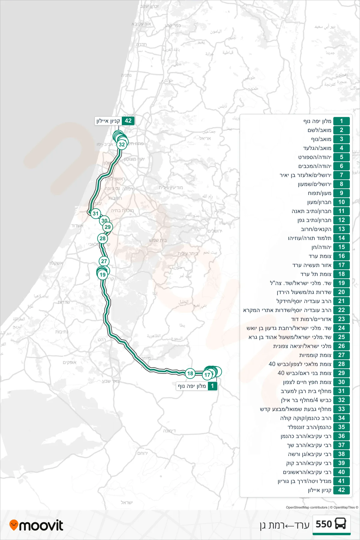
Stops list (550 - Arad→Ramat Gan)
- Yefe Nof Hotel
- Moav/Leshem
- Moav/Nof
- Moav/HaGilad
- Yehuda/HaSport
- Yehuda/HaMaccabim
- Elazar Ben Yair Street Jerusalem
- Jerusalem/Shimon
- Maon/Tapuach
- Hebron/Maon
- Hebron/Fig Path
- Hebron/Nativ Gefen
- HaKanaim/Haruv
- Talmud Torah/Uziyahu
- Yehuda/Chen
- Arad Junction
- Arad Industrial Zone
- Tel Arad Junction
- Kings of Israel Blvd/IDF Blvd
- Gat Boulevard/Jordan Path
- Rabbi Ovadia Yosef/Hidekel
- Rabbi Ovadia Yosef/Biblical Sites Boulevard
- Adoraim/Ramot David
- Kings of Israel Boulevard/Gideon Ben Yoash Plaza
- Israel Kings Blvd/Ehud Ben Gera Path
- Malchei Israel/North Exit
- Komemiyut Junction
- Malachi North Junction/Road 40
- Bnei Ram Junction/Road 40
- Hafetz Haim Junction Northbound
- Beit Raban Interchange West
- Road 4/Bar Ilan Interchange
- Givat Shmuel Interchange/Mivtza Kadesh
- HaRav Kahanan/Coca Cola
- Kahanan/HaRav Sonnenfeld
- Rabbi Akiva/Rav Kahanan
- Rabbi Akiva/HaRav Shach
- Rabbi Akiva/Gan Warsaw
- Rabbi Akiva/HaRav Kook
- Rabbi Akiva/HaRishonim
- Vita Tower/Ben Gurion Road
- Ayalon Mall