
550 Bus Route Map
View the 550 route map and see all 550 stops along the route. The map of 550 shows where the bus travels and the location of each stop, making it easy to understand the entire route at a glance.
Explore RSVG Rhein-Sieg-Verkehrsgesellschaft mbH routes on the map and see where RSVG Rhein-Sieg-Verkehrsgesellschaft mbH bus services operate. Use the 550 map to find bus stops and see how the 550 connects different areas along its trip.
All 550 stops on the map are displayed in route order, helping you follow the 550 bus from the first stop to the last.
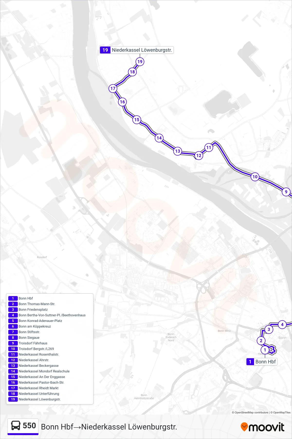
Stops list (550 - Bonn Hbf→Niederkassel Löwenburgstr.)
- Bonn Hbf
- Bonn Thomas-Mann-Str.
- Bonn Friedensplatz
- Bonn Bertha-Von-Suttner-Pl./Beethovenhaus
- Bonn Konrad-Adenauer-Platz
- Bonn am Köppekreuz
- Bonn Stiftsstr.
- Bonn Siegaue
- Troisdorf Fährhaus
- Troisdorf Bergstr./L269
- Niederkassel Rosenthalstr.
- Niederkassel Ahrstr.
- Niederkassel Beckergasse
- Niederkassel Mondorf Realschule
- Niederkassel An Der Enggasse
- Niederkassel Pastor-Ibach-Str.
- Niederkassel Rheidt Markt
- Niederkassel Unterführung
- Niederkassel Löwenburgstr.
Change direction
- Route Map - 550 - Niederkassel Löwenburgstr.→Bonn Hbf
- Route Map - 550 - Bornheim Hersel→Troisdorf Spich Bf
- Route Map - 550 - Bonn Hbf→Troisdorf Spich Bf
- Route Map - 550 - Troisdorf Spich Bf→Bornheim Hersel Grundschule
- Route Map - 550 - Troisdorf Spich Bf→Bonn Josephinum
- Route Map - 550 - Bonn Josephinum→Troisdorf Spich Bf
- Route Map - 550 - Troisdorf Spich Bf→Bonn Hbf