
55B Bus Route Map
View the 55B route map and see all 55B stops along the route. The map of 55B shows where the bus travels and the location of each stop, making it easy to understand the entire route at a glance.
Explore RÖHLER Touristik GmbH routes on the map and see where RÖHLER Touristik GmbH bus services operate. Use the 55B map to find bus stops and see how the 55B connects different areas along its trip.
All 55B stops on the map are displayed in route order, helping you follow the 55B bus from the first stop to the last.
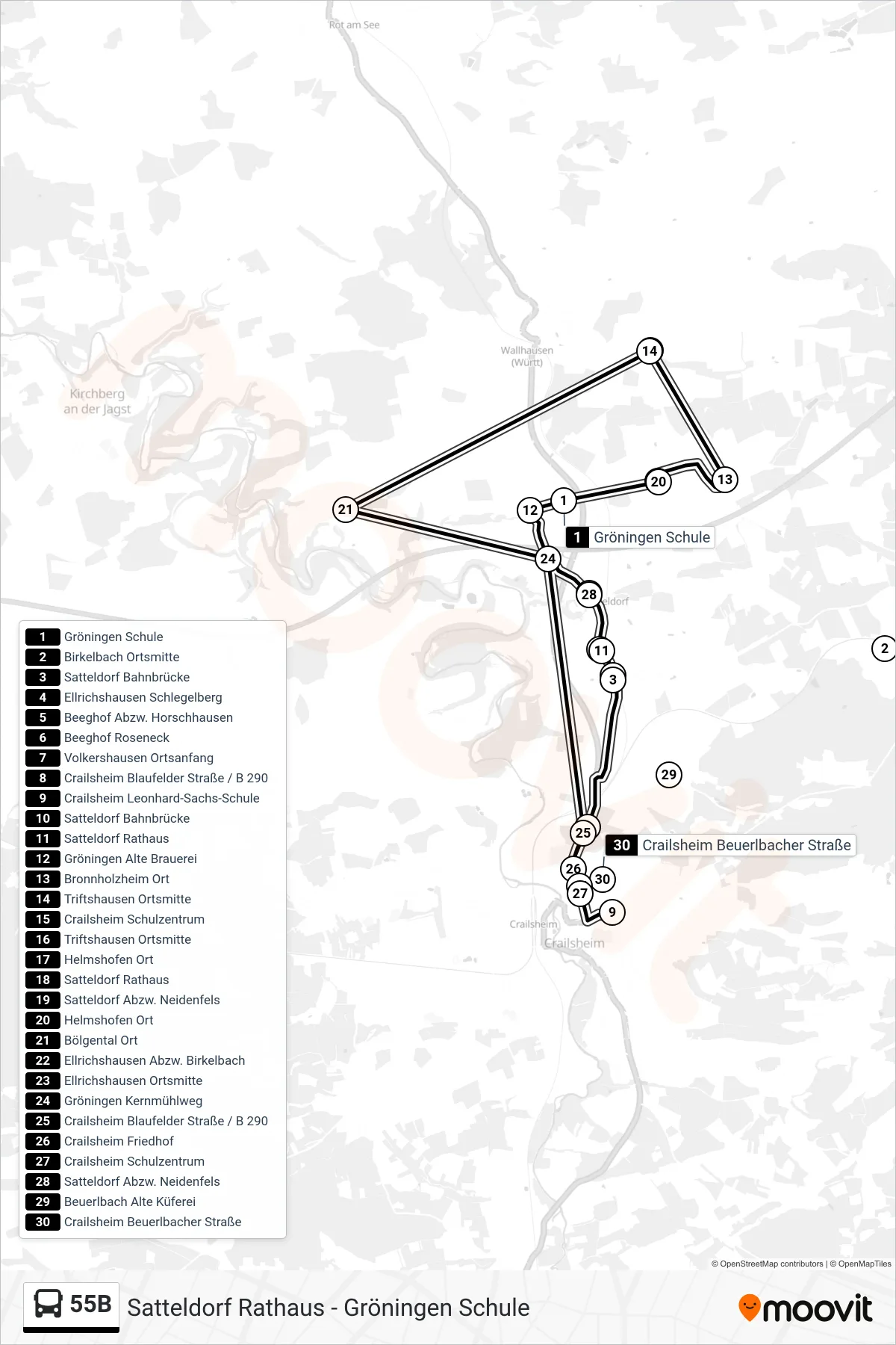
Stops list (55B - Crailsheim Leonhard-Sachs-Schule)
- Gröningen Schule
- Birkelbach Ortsmitte
- Satteldorf Bahnbrücke
- Ellrichshausen Schlegelberg
- Beeghof Abzw. Horschhausen
- Beeghof Roseneck
- Volkershausen Ortsanfang
- Crailsheim Blaufelder Straße / B 290
- Crailsheim Leonhard-Sachs-Schule
- Satteldorf Bahnbrücke
- Satteldorf Rathaus
- Gröningen Alte Brauerei
- Bronnholzheim Ort
- Triftshausen Ortsmitte
- Crailsheim Schulzentrum
- Triftshausen Ortsmitte
- Helmshofen Ort
- Satteldorf Rathaus
- Satteldorf Abzw. Neidenfels
- Helmshofen Ort
- Bölgental Ort
- Ellrichshausen Abzw. Birkelbach
- Ellrichshausen Ortsmitte
- Gröningen Kernmühlweg
- Crailsheim Blaufelder Straße / B 290
- Crailsheim Friedhof
- Crailsheim Schulzentrum
- Satteldorf Abzw. Neidenfels
- Beuerlbach Alte Küferei
- Crailsheim Beuerlbacher Straße