
56 Bus Route Map
View the 56 route map and see all 56 stops along the route. The map of 56 shows where the bus travels and the location of each stop, making it easy to understand the entire route at a glance.
Explore MUNI routes on the map and see where MUNI bus services operate. Use the 56 map to find bus stops and see how the 56 connects different areas along its trip.
All 56 stops on the map are displayed in route order, helping you follow the 56 bus from the first stop to the last.
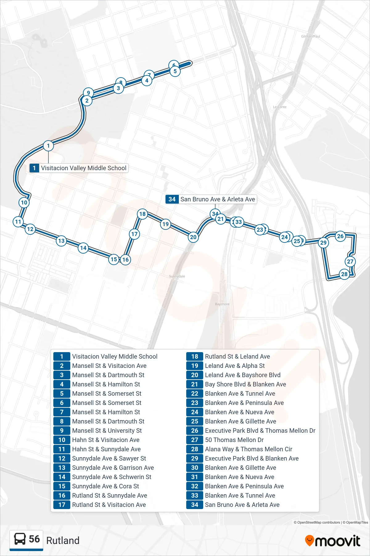
Stops list (56 - Arleta + Bayshore)
- Visitacion Valley Middle School
- Mansell St & Visitacion Ave
- Mansell St & Dartmouth St
- Mansell St & Hamilton St
- Mansell St & Somerset St
- Mansell St & Somerset St
- Mansell St & Hamilton St
- Mansell St & Dartmouth St
- Mansell St & University St
- Hahn St & Visitacion Ave
- Hahn St & Sunnydale Ave
- Sunnydale Ave & Sawyer St
- Sunnydale Ave & Garrison Ave
- Sunnydale Ave & Schwerin St
- Sunnydale Ave & Cora St
- Rutland St & Sunnydale Ave
- Rutland St & Visitacion Ave
- Rutland St & Leland Ave
- Leland Ave & Alpha St
- Leland Ave & Bayshore Blvd
- Bay Shore Blvd & Blanken Ave
- Blanken Ave & Tunnel Ave
- Blanken Ave & Peninsula Ave
- Blanken Ave & Nueva Ave
- Blanken Ave & Gillette Ave
- Executive Park Blvd & Thomas Mellon Dr
- 50 Thomas Mellon Dr
- Alana Way & Thomas Mellon Cir
- Executive Park Blvd & Blanken Ave
- Blanken Ave & Gillette Ave
- Blanken Ave & Nueva Ave
- Blanken Ave & Peninsula Ave
- Blanken Ave & Tunnel Ave
- San Bruno Ave & Arleta Ave