
560 Bus Route Map
View the 560 route map and see all 560 stops along the route. The map of 560 shows where the bus travels and the location of each stop, making it easy to understand the entire route at a glance.
Explore SSB routes on the map and see where SSB bus services operate. Use the 560 map to find bus stops and see how the 560 connects different areas along its trip.
All 560 stops on the map are displayed in route order, helping you follow the 560 bus from the first stop to the last.
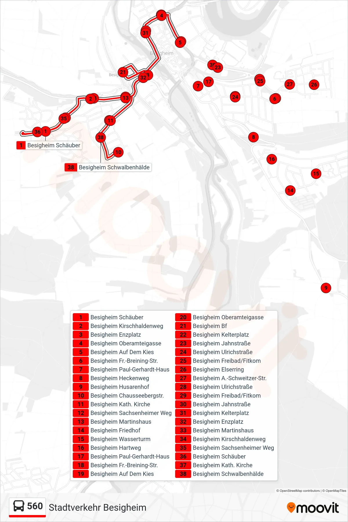
Stops list (560 - Besigheim Chausseebergstr.)
- Besigheim Schäuber
- Besigheim Kirschhaldenweg
- Besigheim Enzplatz
- Besigheim Oberamteigasse
- Besigheim Auf Dem Kies
- Besigheim Fr.-Breining-Str.
- Besigheim Paul-Gerhardt-Haus
- Besigheim Heckenweg
- Besigheim Husarenhof
- Besigheim Chausseebergstr.
- Besigheim Kath. Kirche
- Besigheim Sachsenheimer Weg
- Besigheim Martinshaus
- Besigheim Friedhof
- Besigheim Wasserturm
- Besigheim Hartweg
- Besigheim Paul-Gerhardt-Haus
- Besigheim Fr.-Breining-Str.
- Besigheim Auf Dem Kies
- Besigheim Oberamteigasse
- Besigheim Bf
- Besigheim Kelterplatz
- Besigheim Jahnstraße
- Besigheim Ulrichstraße
- Besigheim Freibad/Fitkom
- Besigheim Elserring
- Besigheim A.-Schweitzer-Str.
- Besigheim Ulrichstraße
- Besigheim Freibad/Fitkom
- Besigheim Jahnstraße
- Besigheim Kelterplatz
- Besigheim Enzplatz
- Besigheim Martinshaus
- Besigheim Kirschhaldenweg
- Besigheim Sachsenheimer Weg
- Besigheim Schäuber
- Besigheim Kath. Kirche
- Besigheim Schwalbenhälde