
560 Tram Route Map
View the 560 route map and see all 560 stops along the route. The map of 560 shows where the tram travels and the location of each stop, making it easy to understand the entire route at a glance.
Explore routes on the map and see where tram services operate. Use the 560 map to find tram stations and see how the 560 connects different areas along its trip.
All 560 stops on the map are displayed in route order, helping you follow the 560 tram from the first station to the last.
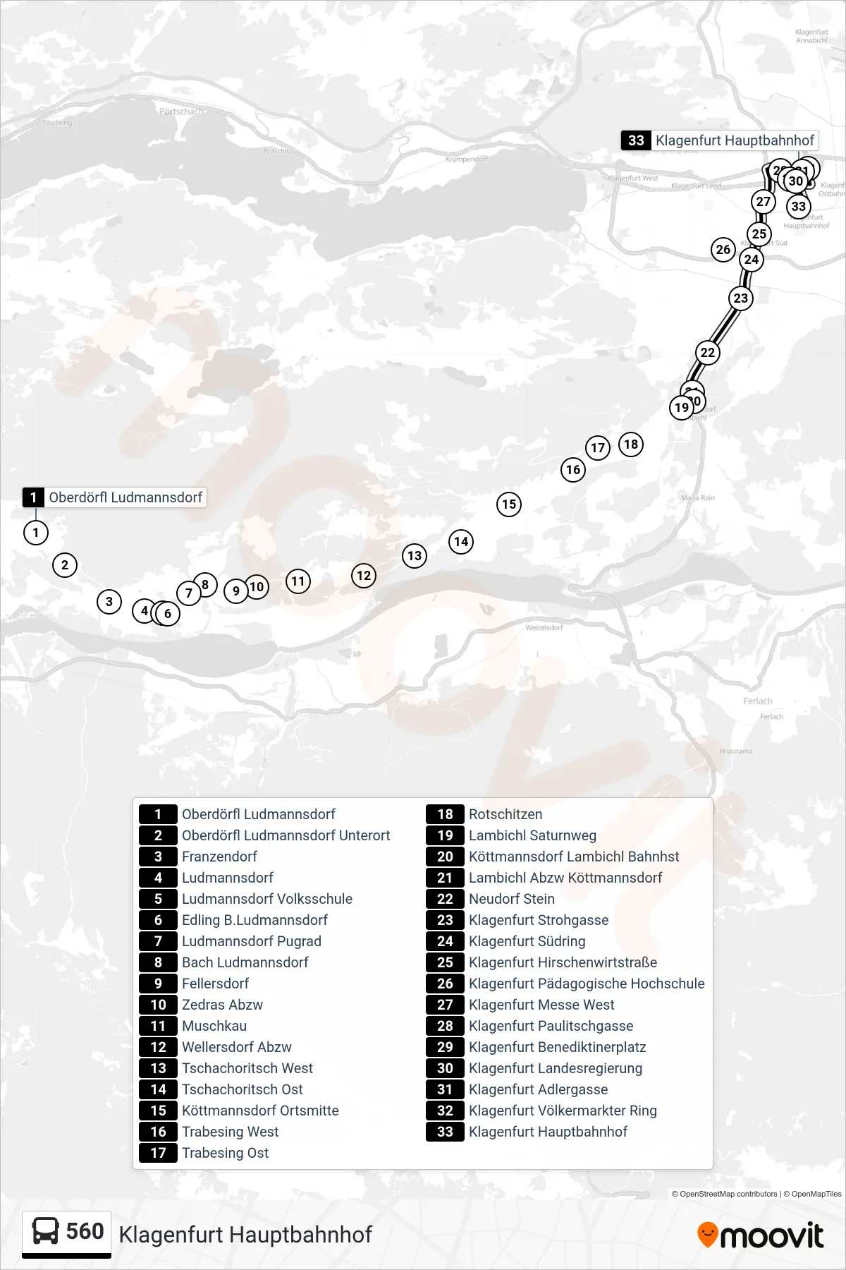
Stops list (560 - Klagenfurt Hauptbahnhof)
- Oberdörfl Ludmannsdorf
- Oberdörfl Ludmannsdorf Unterort
- Franzendorf
- Ludmannsdorf
- Ludmannsdorf Volksschule
- Edling B.Ludmannsdorf
- Ludmannsdorf Pugrad
- Bach Ludmannsdorf
- Fellersdorf
- Zedras Abzw
- Muschkau
- Wellersdorf Abzw
- Tschachoritsch West
- Tschachoritsch Ost
- Köttmannsdorf Ortsmitte
- Trabesing West
- Trabesing Ost
- Rotschitzen
- Lambichl Saturnweg
- Köttmannsdorf Lambichl Bahnhst
- Lambichl Abzw Köttmannsdorf
- Neudorf Stein
- Klagenfurt Strohgasse
- Klagenfurt Südring
- Klagenfurt Hirschenwirtstraße
- Klagenfurt Pädagogische Hochschule
- Klagenfurt Messe West
- Klagenfurt Paulitschgasse
- Klagenfurt Benediktinerplatz
- Klagenfurt Landesregierung
- Klagenfurt Adlergasse
- Klagenfurt Völkermarkter Ring
- Klagenfurt Hauptbahnhof
Change direction
- Route Map - 560 - Klagenfurt Stauderplatz
- Route Map - 560 - Oberdörfl Ludmannsdorf
- Route Map - 560 - Feistritz Im Rosental Gemeindeamt
- Route Map - 560 - Ludmannsdorf Volksschule
- Route Map - 560 - Klagenfurt Viktring Schule
- Route Map - 560 - Köttmannsdorf Lambichl Bahnhst
- Route Map - 560 - Köttmannsdorf Lambichl Bahnhst
- Route Map - 560 - Niederdörfl Ödk