
569 Bus Route Map
View the 569 route map and see all 569 stops along the route. The map of 569 shows where the bus travels and the location of each stop, making it easy to understand the entire route at a glance.
Explore PACE routes on the map and see where PACE bus services operate. Use the 569 map to find bus stops and see how the 569 connects different areas along its trip.
All 569 stops on the map are displayed in route order, helping you follow the 569 bus from the first stop to the last.
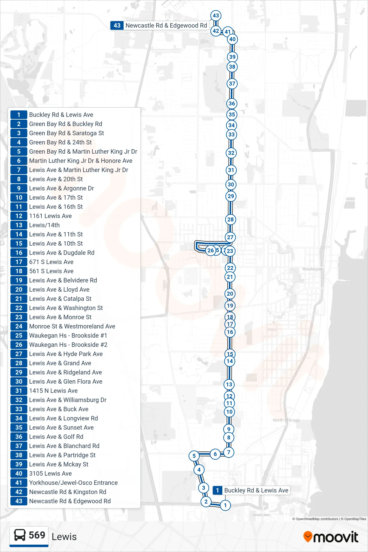
Stops list (569 - Newcastle Rd & Edgewood Rd)
- Buckley Rd & Lewis Ave
- Green Bay Rd & Buckley Rd
- Green Bay Rd & Saratoga St
- Green Bay Rd & 24th St
- Green Bay Rd & Martin Luther King Jr Dr
- Martin Luther King Jr Dr & Honore Ave
- Lewis Ave & Martin Luther King Jr Dr
- Lewis Ave & 20th St
- Lewis Ave & Argonne Dr
- Lewis Ave & 17th St
- Lewis Ave & 16th St
- 1161 Lewis Ave
- Lewis/14th
- Lewis Ave & 11th St
- Lewis Ave & 10th St
- Lewis Ave & Dugdale Rd
- 671 S Lewis Ave
- 561 S Lewis Ave
- Lewis Ave & Belvidere Rd
- Lewis Ave & Lloyd Ave
- Lewis Ave & Catalpa St
- Lewis Ave & Washington St
- Lewis Ave & Monroe St
- Monroe St & Westmoreland Ave
- Waukegan Hs - Brookside #1
- Waukegan Hs - Brookside #2
- Lewis Ave & Hyde Park Ave
- Lewis Ave & Grand Ave
- Lewis Ave & Ridgeland Ave
- Lewis Ave & Glen Flora Ave
- 1415 N Lewis Ave
- Lewis Ave & Williamsburg Dr
- Lewis Ave & Buck Ave
- Lewis Ave & Longview Rd
- Lewis Ave & Sunset Ave
- Lewis Ave & Golf Rd
- Lewis Ave & Blanchard Rd
- Lewis Ave & Partridge St
- Lewis Ave & Mckay St
- 3105 Lewis Ave
- Yorkhouse/Jewel-Osco Entrance
- Newcastle Rd & Kingston Rd
- Newcastle Rd & Edgewood Rd