
56A Bus Route Map
View the 56A route map and see all 56A stops along the route. The map of 56A shows where the bus travels and the location of each stop, making it easy to understand the entire route at a glance.
Explore Bus Átha Cliath – Dublin Bus routes on the map and see where Bus Átha Cliath – Dublin Bus bus services operate. Use the 56A map to find bus stops and see how the 56A connects different areas along its trip.
All 56A stops on the map are displayed in route order, helping you follow the 56A bus from the first stop to the last.
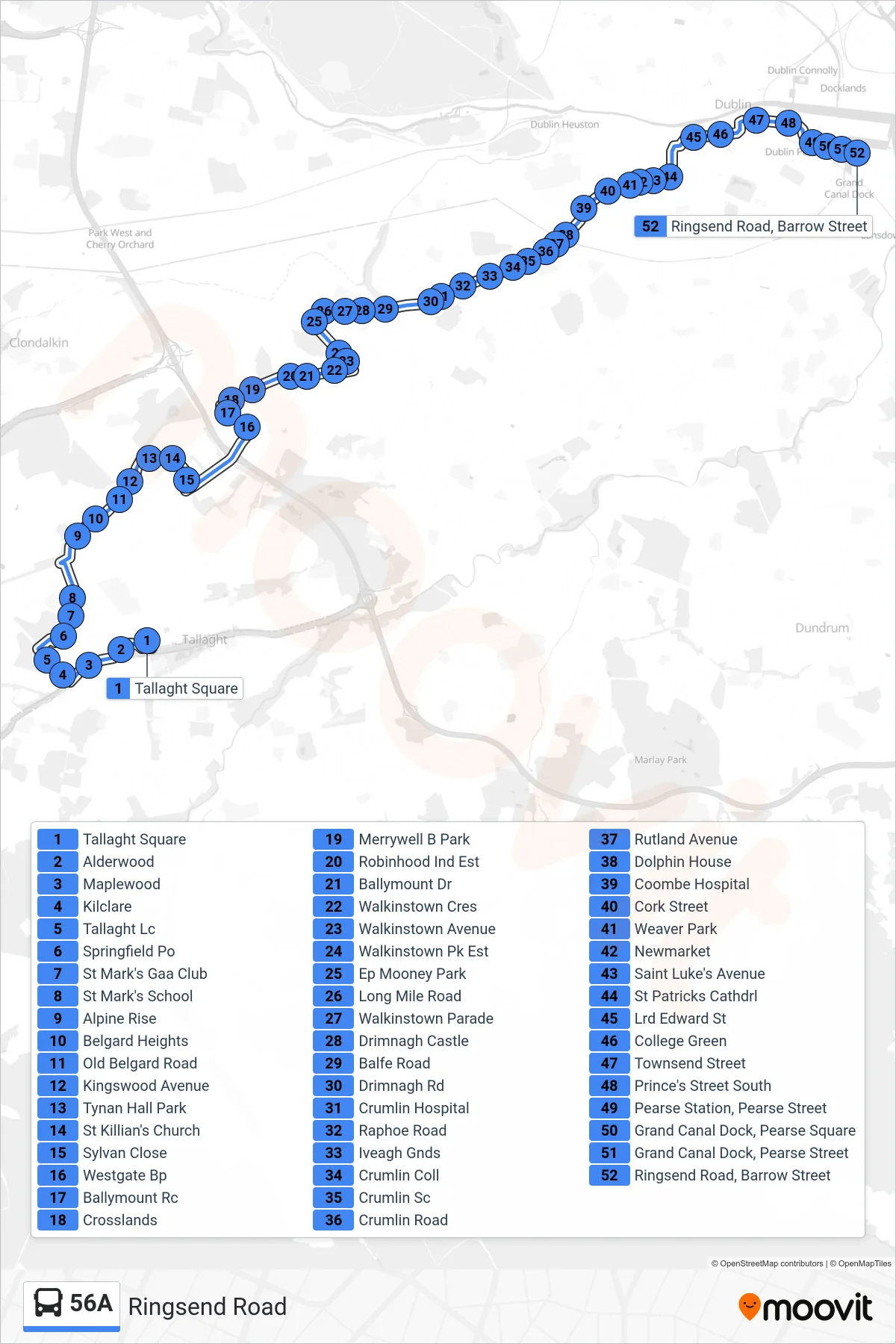
Stops list (56A - Ringsend Road)
- Tallaght Square
- Alderwood
- Maplewood
- Kilclare
- Tallaght Lc
- Springfield Po
- St Mark's Gaa Club
- St Mark's School
- Alpine Rise
- Belgard Heights
- Old Belgard Road
- Kingswood Avenue
- Tynan Hall Park
- St Killian's Church
- Sylvan Close
- Westgate Bp
- Ballymount Rc
- Crosslands
- Merrywell B Park
- Robinhood Ind Est
- Ballymount Dr
- Walkinstown Cres
- Walkinstown Avenue
- Walkinstown Pk Est
- Ep Mooney Park
- Long Mile Road
- Walkinstown Parade
- Drimnagh Castle
- Balfe Road
- Drimnagh Rd
- Crumlin Hospital
- Raphoe Road
- Iveagh Gnds
- Crumlin Coll
- Crumlin Sc
- Crumlin Road
- Rutland Avenue
- Dolphin House
- Coombe Hospital
- Cork Street
- Weaver Park
- Newmarket
- Saint Luke's Avenue
- St Patricks Cathdrl
- Lrd Edward St
- College Green
- Townsend Street
- Prince's Street South
- Pearse Station, Pearse Street
- Grand Canal Dock, Pearse Square
- Grand Canal Dock, Pearse Street
- Ringsend Road, Barrow Street