
57 Bus Route Map
View the 57 route map and see all 57 stops along the route. The map of 57 shows where the bus travels and the location of each stop, making it easy to understand the entire route at a glance.
Explore Rhode Island Public Transit Authority routes on the map and see where Rhode Island Public Transit Authority bus services operate. Use the 57 map to find bus stops and see how the 57 connects different areas along its trip.
All 57 stops on the map are displayed in route order, helping you follow the 57 bus from the first stop to the last.
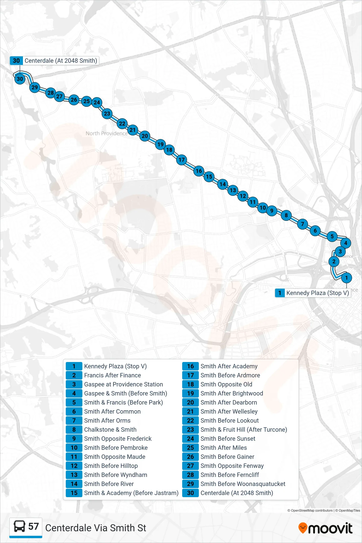
Stops list (57 - Centerdale Via Smith St)
- Kennedy Plaza (Stop V)
- Francis After Finance
- Gaspee at Providence Station
- Gaspee & Smith (Before Smith)
- Smith & Francis (Before Park)
- Smith After Common
- Smith After Orms
- Chalkstone & Smith
- Smith Opposite Frederick
- Smith Before Pembroke
- Smith Opposite Maude
- Smith Before Hilltop
- Smith Before Wyndham
- Smith Before River
- Smith & Academy (Before Jastram)
- Smith After Academy
- Smith Before Ardmore
- Smith Opposite Old
- Smith After Brightwood
- Smith After Dearborn
- Smith After Wellesley
- Smith Before Lookout
- Smith & Fruit Hill (After Turcone)
- Smith Before Sunset
- Smith After Miles
- Smith Before Gainer
- Smith Opposite Fenway
- Smith Before Ferncliff
- Smith Before Woonasquatucket
- Centerdale (At 2048 Smith)