
57 Bus Route Map
View the 57 route map and see all 57 stops along the route. The map of 57 shows where the bus travels and the location of each stop, making it easy to understand the entire route at a glance.
Explore SamTrans routes on the map and see where SamTrans bus services operate. Use the 57 map to find bus stops and see how the 57 connects different areas along its trip.
All 57 stops on the map are displayed in route order, helping you follow the 57 bus from the first stop to the last.
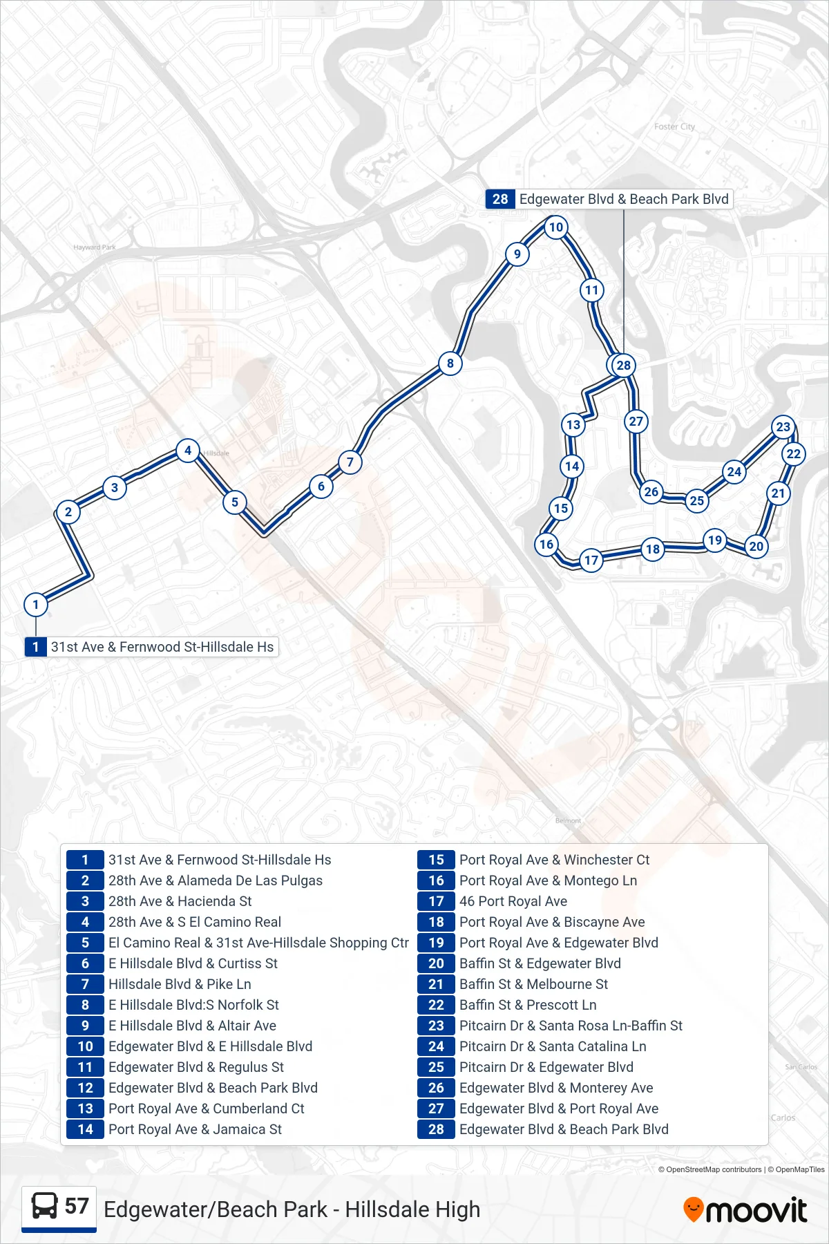
Stops list (57 - Foster City)
- 31st Ave & Fernwood St-Hillsdale Hs
- 28th Ave & Alameda De Las Pulgas
- 28th Ave & Hacienda St
- 28th Ave & S El Camino Real
- El Camino Real & 31st Ave-Hillsdale Shopping Ctr
- E Hillsdale Blvd & Curtiss St
- Hillsdale Blvd & Pike Ln
- E Hillsdale Blvd:S Norfolk St
- E Hillsdale Blvd & Altair Ave
- Edgewater Blvd & E Hillsdale Blvd
- Edgewater Blvd & Regulus St
- Edgewater Blvd & Beach Park Blvd
- Port Royal Ave & Cumberland Ct
- Port Royal Ave & Jamaica St
- Port Royal Ave & Winchester Ct
- Port Royal Ave & Montego Ln
- 46 Port Royal Ave
- Port Royal Ave & Biscayne Ave
- Port Royal Ave & Edgewater Blvd
- Baffin St & Edgewater Blvd
- Baffin St & Melbourne St
- Baffin St & Prescott Ln
- Pitcairn Dr & Santa Rosa Ln-Baffin St
- Pitcairn Dr & Santa Catalina Ln
- Pitcairn Dr & Edgewater Blvd
- Edgewater Blvd & Monterey Ave
- Edgewater Blvd & Port Royal Ave
- Edgewater Blvd & Beach Park Blvd