
570 Bus Route Map
View the 570 route map and see all 570 stops along the route. The map of 570 shows where the bus travels and the location of each stop, making it easy to understand the entire route at a glance.
Explore Verkehrsverbund Elbe Elster routes on the map and see where Verkehrsverbund Elbe Elster bus services operate. Use the 570 map to find bus stops and see how the 570 connects different areas along its trip.
All 570 stops on the map are displayed in route order, helping you follow the 570 bus from the first stop to the last.
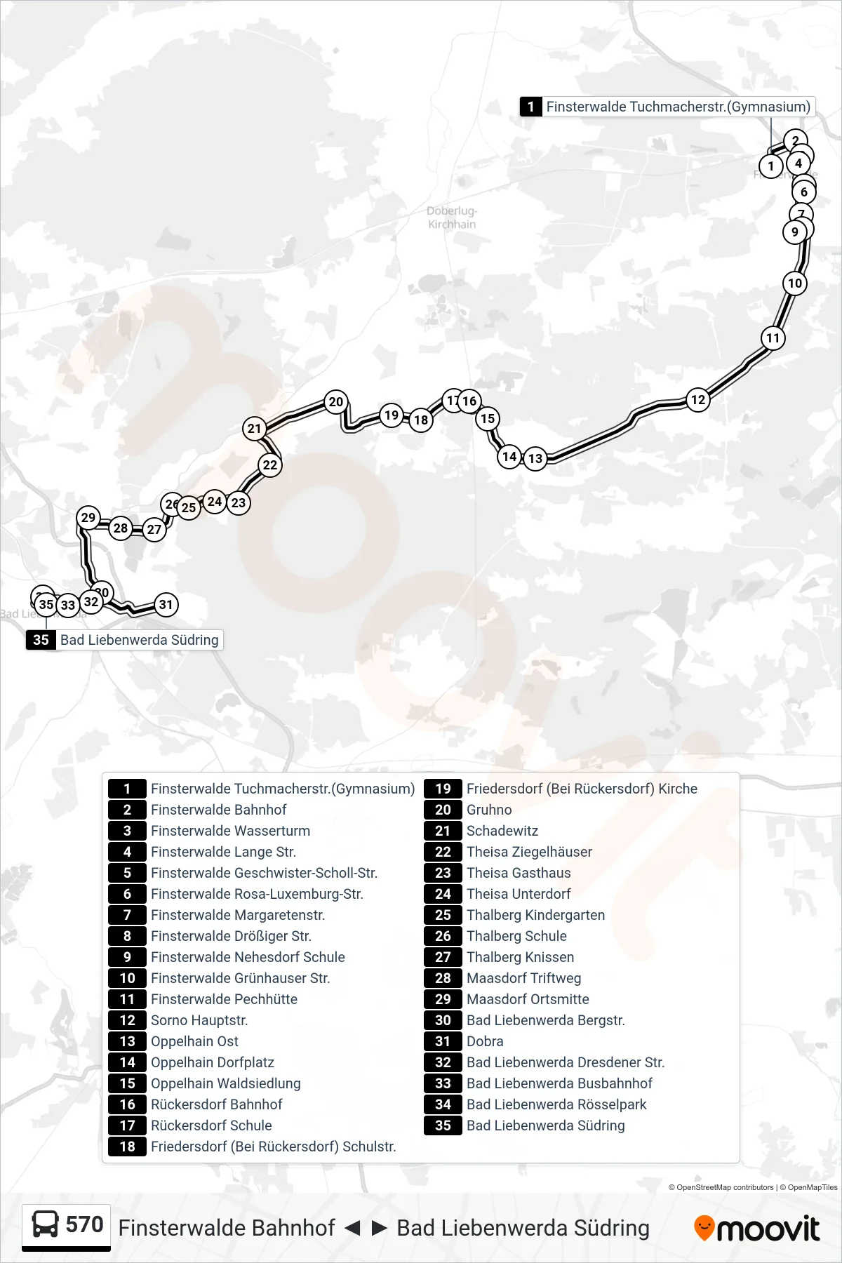
Stops list (570 - Bad Liebenwerda Südring)
- Finsterwalde Tuchmacherstr.(Gymnasium)
- Finsterwalde Bahnhof
- Finsterwalde Wasserturm
- Finsterwalde Lange Str.
- Finsterwalde Geschwister-Scholl-Str.
- Finsterwalde Rosa-Luxemburg-Str.
- Finsterwalde Margaretenstr.
- Finsterwalde Drößiger Str.
- Finsterwalde Nehesdorf Schule
- Finsterwalde Grünhauser Str.
- Finsterwalde Pechhütte
- Sorno Hauptstr.
- Oppelhain Ost
- Oppelhain Dorfplatz
- Oppelhain Waldsiedlung
- Rückersdorf Bahnhof
- Rückersdorf Schule
- Friedersdorf (Bei Rückersdorf) Schulstr.
- Friedersdorf (Bei Rückersdorf) Kirche
- Gruhno
- Schadewitz
- Theisa Ziegelhäuser
- Theisa Gasthaus
- Theisa Unterdorf
- Thalberg Kindergarten
- Thalberg Schule
- Thalberg Knissen
- Maasdorf Triftweg
- Maasdorf Ortsmitte
- Bad Liebenwerda Bergstr.
- Dobra
- Bad Liebenwerda Dresdener Str.
- Bad Liebenwerda Busbahnhof
- Bad Liebenwerda Rösselpark
- Bad Liebenwerda Südring