
570 Bus Route Map
View the 570 route map and see all 570 stops along the route. The map of 570 shows where the bus travels and the location of each stop, making it easy to understand the entire route at a glance.
Explore Metropoline routes on the map and see where Metropoline bus services operate. Use the 570 map to find bus stops and see how the 570 connects different areas along its trip.
All 570 stops on the map are displayed in route order, helping you follow the 570 bus from the first stop to the last.
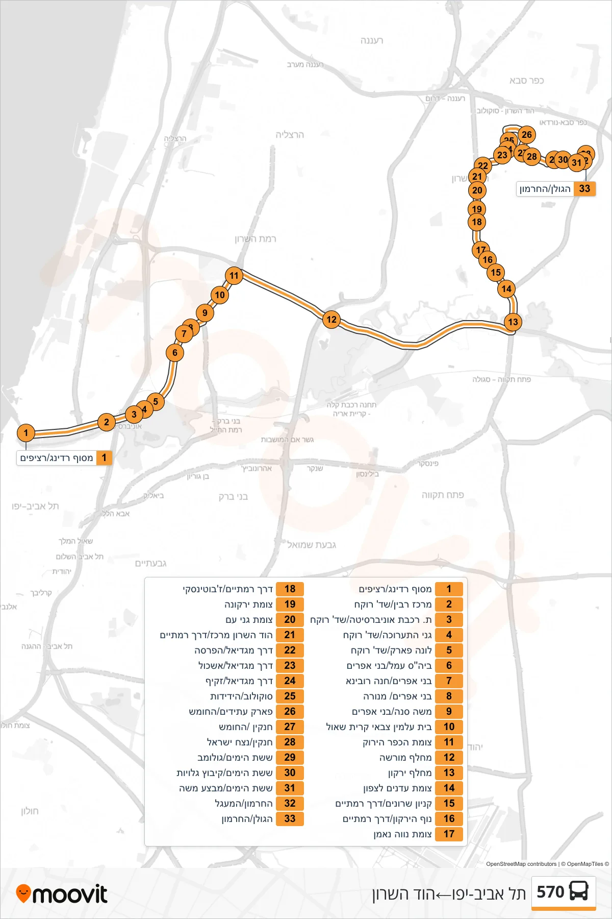
Stops list (570 - Tel Aviv-Yafo→Hod HaSharon)
- Reading Terminal/Platforms
- Rabin Center/Rokach Boulevard
- University Railway Station/Rokach Blvd
- Exhibition Gardens/Rokach Blvd
- Luna Park/Rokach Boulevard
- Amal School/Bnei Efraim
- Bnei Efraim/Hanna Rubina
- Bnei Efraim/Menora
- Moshe Sneh/Bnei Efraim
- Kiryat Shaul Military Cemetery
- Green Village Junction
- Morasha Interchange
- Yarkon Interchange
- Adanim North Junction
- Sharon Mall/Ramatayim Road
- Nof HaYarkon/Ramatayim Road
- Neve Ne'eman Junction
- Derech Ramatayim/Jabotinsky
- Yarkona Junction
- Ganei Am Junction
- Hod HaSharon Center/Ramatayim Road
- Magdiel Road/HaParsa
- Magdiel/Eshkol Road
- Magdiel Road/Zakif
- Sokolov/HaYedidut
- Park Atidim/HaHomesh
- Hankin/HaHomesh
- Hankin/Netzach Israel
- Sheshet HaYamim/Golomb
- Sheshet HaYamim/Kibbutz Galuyot
- Six Day War/Mivtza Moshe
- HaHermon/HaMa'agal
- HaGolan/HaHermon