
58 Bus Route Map
View the 58 route map and see all 58 stops along the route. The map of 58 shows where the bus travels and the location of each stop, making it easy to understand the entire route at a glance.
Explore NJ Transit routes on the map and see where NJ Transit bus services operate. Use the 58 map to find bus stops and see how the 58 connects different areas along its trip.
All 58 stops on the map are displayed in route order, helping you follow the 58 bus from the first stop to the last.
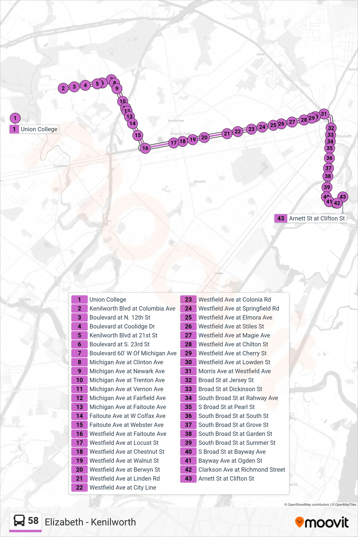
Stops list (58 - Elizabeth Clarkson Ave)
- Union College
- Kenilworth Blvd at Columbia Ave
- Boulevard at N. 12th St
- Boulevard at Coolidge Dr
- Kenilworth Blvd at 21st St
- Boulevard at S. 23rd St
- Boulevard 60' W Of Michigan Ave
- Michigan Ave at Clinton Ave
- Michigan Ave at Newark Ave
- Michigan Ave at Trenton Ave
- Michigan Ave at Vernon Ave
- Michigan Ave at Fairfield Ave
- Michigan Ave at Faitoute Ave
- Faitoute Ave at W Colfax Ave
- Faitoute Ave at Webster Ave
- Westfield Ave at Faitoute Ave
- Westfield Ave at Locust St
- Westfield Ave at Chestnut St
- Westfield Ave at Walnut St
- Westfield Ave at Berwyn St
- Westfield Ave at Linden Rd
- Westfield Ave at City Line
- Westfield Ave at Colonia Rd
- Westfield Ave at Springfield Rd
- Westfield Ave at Elmora Ave
- Westfield Ave at Stiles St
- Westfield Ave at Magie Ave
- Westfield Ave at Chilton St
- Westfield Ave at Cherry St
- Westfield Ave at Lowden St
- Morris Ave at Westfield Ave
- Broad St at Jersey St
- Broad St at Dickinson St
- South Broad St at Rahway Ave
- S Broad St at Pearl St
- South Broad St at South St
- South Broad St at Grove St
- South Broad St at Garden St
- South Broad St at Summer St
- S Broad St at Bayway Ave
- Bayway Ave at Ogden St
- Clarkson Ave at Richmond Street
- Arnett St at Clifton St