
58 Bus Route Map
View the 58 route map and see all 58 stops along the route. The map of 58 shows where the bus travels and the location of each stop, making it easy to understand the entire route at a glance.
Explore RAB routes on the map and see where RAB bus services operate. Use the 58 map to find bus stops and see how the 58 connects different areas along its trip.
All 58 stops on the map are displayed in route order, helping you follow the 58 bus from the first stop to the last.
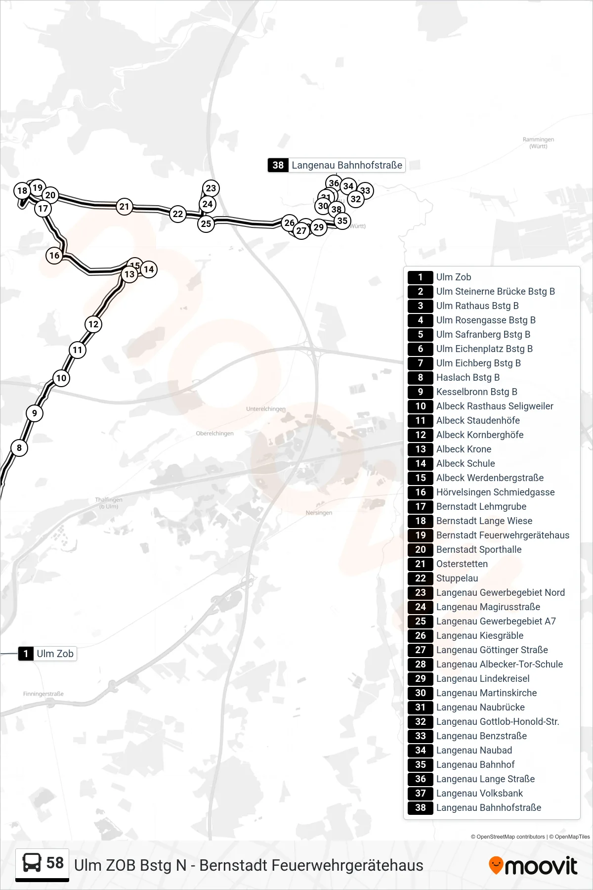
Stops list (58 - Langenau Bahnhof)
- Ulm Zob
- Ulm Steinerne Brücke Bstg B
- Ulm Rathaus Bstg B
- Ulm Rosengasse Bstg B
- Ulm Safranberg Bstg B
- Ulm Eichenplatz Bstg B
- Ulm Eichberg Bstg B
- Haslach Bstg B
- Kesselbronn Bstg B
- Albeck Rasthaus Seligweiler
- Albeck Staudenhöfe
- Albeck Kornberghöfe
- Albeck Krone
- Albeck Schule
- Albeck Werdenbergstraße
- Hörvelsingen Schmiedgasse
- Bernstadt Lehmgrube
- Bernstadt Lange Wiese
- Bernstadt Feuerwehrgerätehaus
- Bernstadt Sporthalle
- Osterstetten
- Stuppelau
- Langenau Gewerbegebiet Nord
- Langenau Magirusstraße
- Langenau Gewerbegebiet A7
- Langenau Kiesgräble
- Langenau Göttinger Straße
- Langenau Albecker-Tor-Schule
- Langenau Lindekreisel
- Langenau Martinskirche
- Langenau Naubrücke
- Langenau Gottlob-Honold-Str.
- Langenau Benzstraße
- Langenau Naubad
- Langenau Bahnhof
- Langenau Lange Straße
- Langenau Volksbank
- Langenau Bahnhofstraße
Change direction
- Route Map - 58 - Bernstadt Feuerwehrgerätehaus
- Route Map - 58 - Hörvelsingen Schmiedgasse
- Route Map - 58 - Albeck Schule
- Route Map - 58 - Haslach
- Route Map - 58 - Albeck Schule
- Route Map - 58 - Langenau Auf Der Reutte
- Route Map - 58 - Langenau Volksbank
- Route Map - 58 - Ulm Zob
- Route Map - 58 - Bernstadt Feuerwehrgerätehaus
- Route Map - 58 - Langenau Benzstraße