
58 Bus Route Map
View the 58 route map and see all 58 stops along the route. The map of 58 shows where the bus travels and the location of each stop, making it easy to understand the entire route at a glance.
Explore Friedrich Müller Omnibusunternehmen GmbH routes on the map and see where Friedrich Müller Omnibusunternehmen GmbH bus services operate. Use the 58 map to find bus stops and see how the 58 connects different areas along its trip.
All 58 stops on the map are displayed in route order, helping you follow the 58 bus from the first stop to the last.
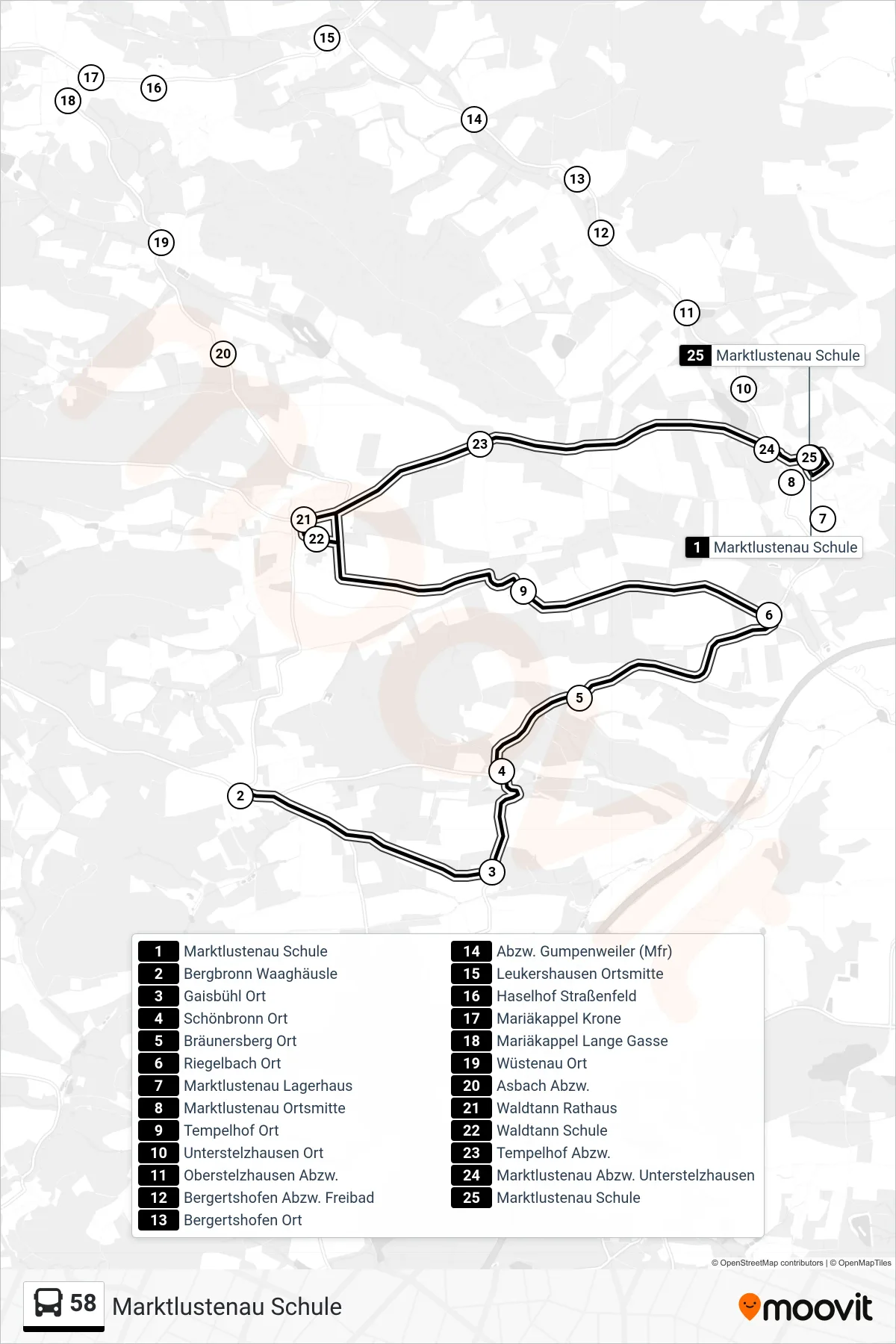
Stops list (58 - Marktlustenau Schule)
- Marktlustenau Schule
- Bergbronn Waaghäusle
- Gaisbühl Ort
- Schönbronn Ort
- Bräunersberg Ort
- Riegelbach Ort
- Marktlustenau Lagerhaus
- Marktlustenau Ortsmitte
- Tempelhof Ort
- Unterstelzhausen Ort
- Oberstelzhausen Abzw.
- Bergertshofen Abzw. Freibad
- Bergertshofen Ort
- Abzw. Gumpenweiler (Mfr)
- Leukershausen Ortsmitte
- Haselhof Straßenfeld
- Mariäkappel Krone
- Mariäkappel Lange Gasse
- Wüstenau Ort
- Asbach Abzw.
- Waldtann Rathaus
- Waldtann Schule
- Tempelhof Abzw.
- Marktlustenau Abzw. Unterstelzhausen
- Marktlustenau Schule
Change direction
- Route Map - 58 - Crailsheim Zob
- Route Map - 58 - Bergbronn Dinkelsbühler Straße
- Route Map - 58 - Crailsheim Schönebürgstraße / Jahnhalle
- Route Map - 58 - Hilpertsweiler
- Route Map - 58 - Feuchtwangen Mooswiese
- Route Map - 58 - Crailsheim Eichendorff-Schule
- Route Map - 58 - Waldtann Friedhof
- Route Map - 58 - Crailsheim Schulzentrum