
59 Bus Route Map
View the 59 route map and see all 59 stops along the route. The map of 59 shows where the bus travels and the location of each stop, making it easy to understand the entire route at a glance.
Explore Regional Transportation District routes on the map and see where Regional Transportation District bus services operate. Use the 59 map to find bus stops and see how the 59 connects different areas along its trip.
All 59 stops on the map are displayed in route order, helping you follow the 59 bus from the first stop to the last.
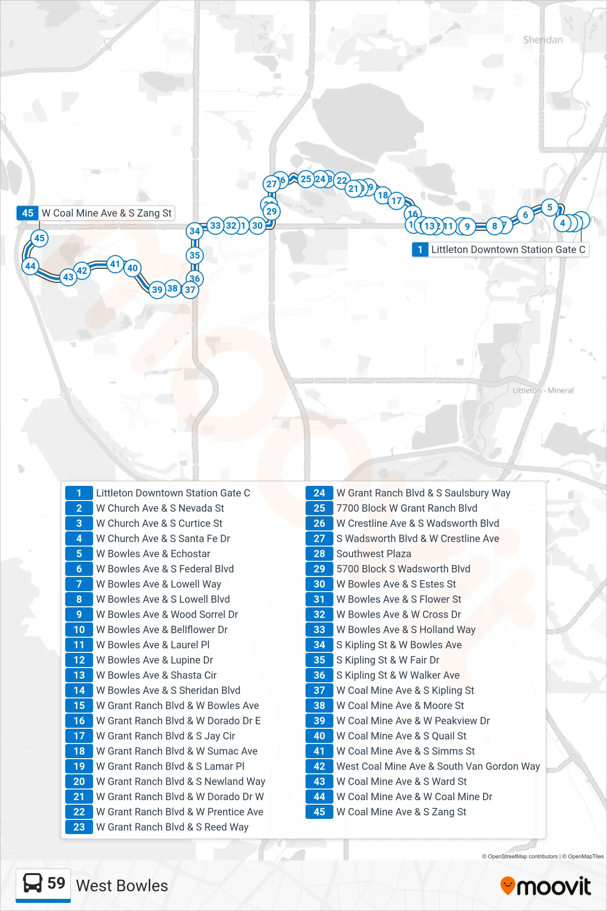
Stops list (59 - Coal Mine/Bowles)
- Littleton Downtown Station Gate C
- W Church Ave & S Nevada St
- W Church Ave & S Curtice St
- W Church Ave & S Santa Fe Dr
- W Bowles Ave & Echostar
- W Bowles Ave & S Federal Blvd
- W Bowles Ave & Lowell Way
- W Bowles Ave & S Lowell Blvd
- W Bowles Ave & Wood Sorrel Dr
- W Bowles Ave & Bellflower Dr
- W Bowles Ave & Laurel Pl
- W Bowles Ave & Lupine Dr
- W Bowles Ave & Shasta Cir
- W Bowles Ave & S Sheridan Blvd
- W Grant Ranch Blvd & W Bowles Ave
- W Grant Ranch Blvd & W Dorado Dr E
- W Grant Ranch Blvd & S Jay Cir
- W Grant Ranch Blvd & W Sumac Ave
- W Grant Ranch Blvd & S Lamar Pl
- W Grant Ranch Blvd & S Newland Way
- W Grant Ranch Blvd & W Dorado Dr W
- W Grant Ranch Blvd & W Prentice Ave
- W Grant Ranch Blvd & S Reed Way
- W Grant Ranch Blvd & S Saulsbury Way
- 7700 Block W Grant Ranch Blvd
- W Crestline Ave & S Wadsworth Blvd
- S Wadsworth Blvd & W Crestline Ave
- Southwest Plaza
- 5700 Block S Wadsworth Blvd
- W Bowles Ave & S Estes St
- W Bowles Ave & S Flower St
- W Bowles Ave & W Cross Dr
- W Bowles Ave & S Holland Way
- S Kipling St & W Bowles Ave
- S Kipling St & W Fair Dr
- S Kipling St & W Walker Ave
- W Coal Mine Ave & S Kipling St
- W Coal Mine Ave & Moore St
- W Coal Mine Ave & W Peakview Dr
- W Coal Mine Ave & S Quail St
- W Coal Mine Ave & S Simms St
- West Coal Mine Ave & South Van Gordon Way
- W Coal Mine Ave & S Ward St
- W Coal Mine Ave & W Coal Mine Dr
- W Coal Mine Ave & S Zang St