
5B Bus Route Map
View the 5B route map and see all 5B stops along the route. The map of 5B shows where the bus travels and the location of each stop, making it easy to understand the entire route at a glance.
Explore De Lijn routes on the map and see where De Lijn bus services operate. Use the 5B map to find bus stops and see how the 5B connects different areas along its trip.
All 5B stops on the map are displayed in route order, helping you follow the 5B bus from the first stop to the last.
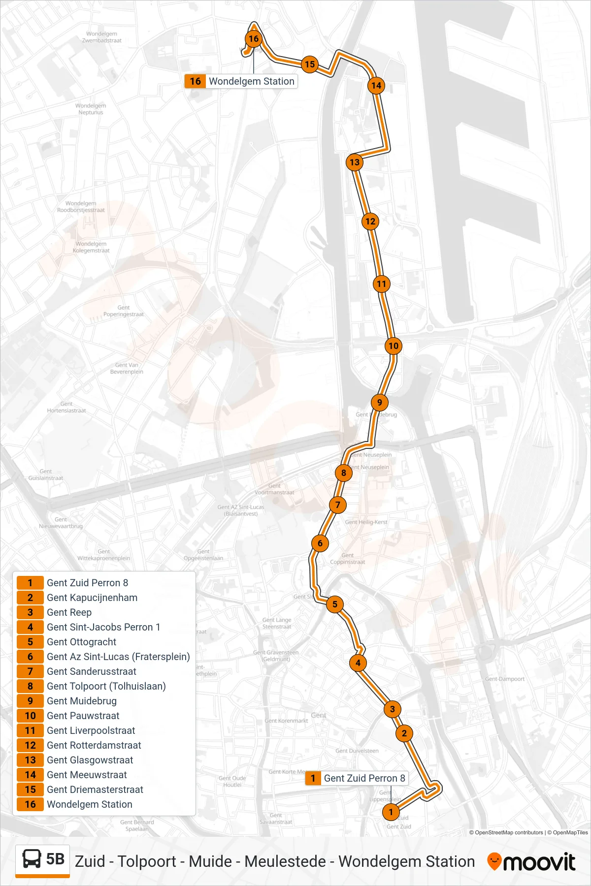
Stops list (5B - Wondelgem Station)
- Ghent South Platform 8
- Ghent Kapucijnenham
- Ghent Reep
- Ghent Sint-Jacobs Platform 1
- Ghent Ottogracht
- Ghent St. Lucas Hospital (Fratersplein)
- Ghent Sanderus Street
- Ghent Toll Gate (Toll House Lane)
- Ghent Muide Bridge
- Ghent Pauw Street
- Ghent Liverpool Street
- Ghent Rotterdam Street
- Ghent Glasgow Street
- Ghent Meeuws Street
- Driemasterstraat Ghent
- Wondelgem Station