
5B Bus Route Map
View the 5B route map and see all 5B stops along the route. The map of 5B shows where the bus travels and the location of each stop, making it easy to understand the entire route at a glance.
Explore Rüsselsheimer Mobilität routes on the map and see where Rüsselsheimer Mobilität bus services operate. Use the 5B map to find bus stops and see how the 5B connects different areas along its trip.
All 5B stops on the map are displayed in route order, helping you follow the 5B bus from the first stop to the last.
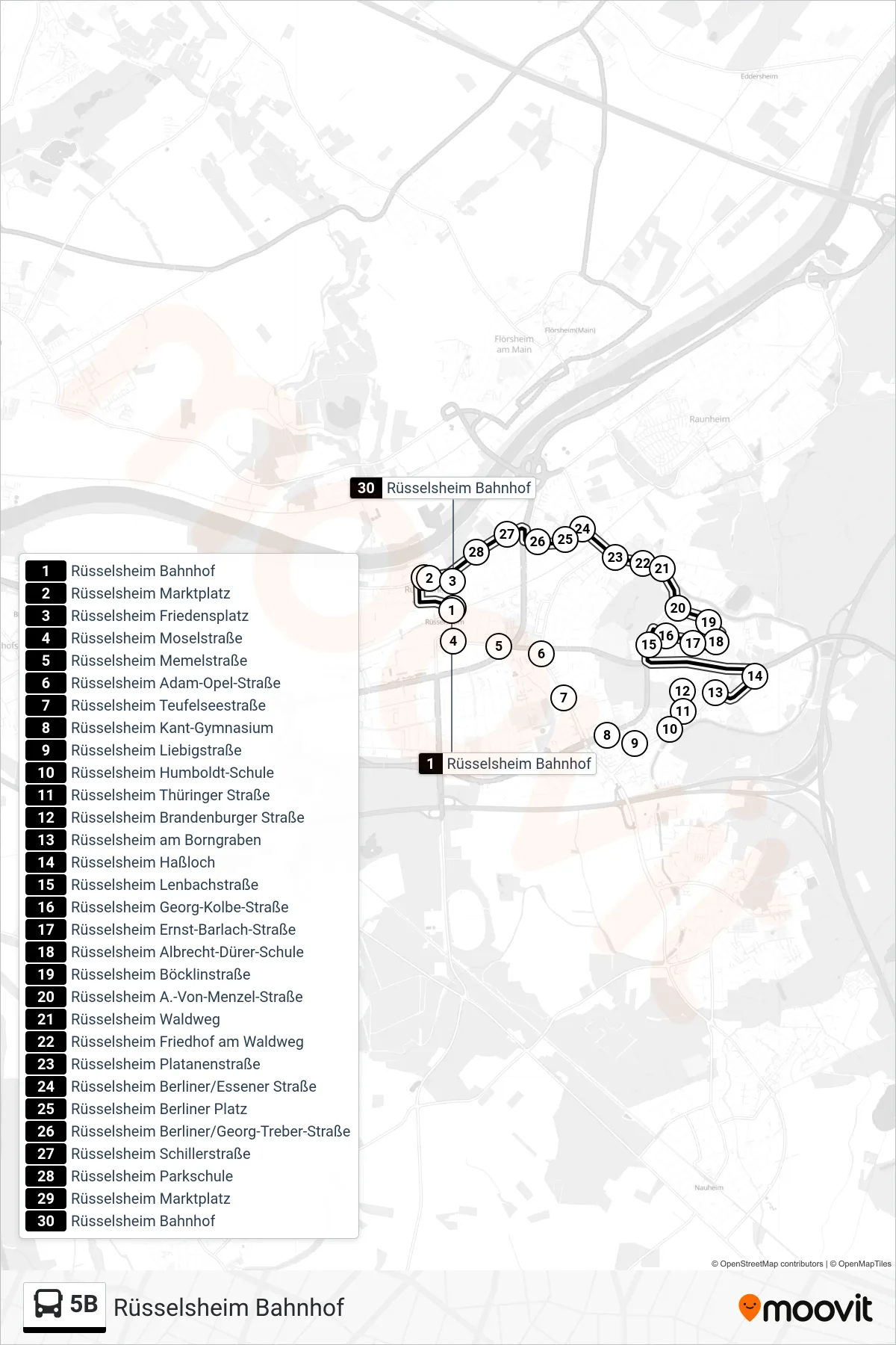
Stops list (5B - Rüsselsheim Bahnhof)
- Rüsselsheim Bahnhof
- Rüsselsheim Marktplatz
- Rüsselsheim Friedensplatz
- Rüsselsheim Moselstraße
- Rüsselsheim Memelstraße
- Rüsselsheim Adam-Opel-Straße
- Rüsselsheim Teufelseestraße
- Rüsselsheim Kant-Gymnasium
- Rüsselsheim Liebigstraße
- Rüsselsheim Humboldt-Schule
- Rüsselsheim Thüringer Straße
- Rüsselsheim Brandenburger Straße
- Rüsselsheim am Borngraben
- Rüsselsheim Haßloch
- Rüsselsheim Lenbachstraße
- Rüsselsheim Georg-Kolbe-Straße
- Rüsselsheim Ernst-Barlach-Straße
- Rüsselsheim Albrecht-Dürer-Schule
- Rüsselsheim Böcklinstraße
- Rüsselsheim A.-Von-Menzel-Straße
- Rüsselsheim Waldweg
- Rüsselsheim Friedhof am Waldweg
- Rüsselsheim Platanenstraße
- Rüsselsheim Berliner/Essener Straße
- Rüsselsheim Berliner Platz
- Rüsselsheim Berliner/Georg-Treber-Straße
- Rüsselsheim Schillerstraße
- Rüsselsheim Parkschule
- Rüsselsheim Marktplatz
- Rüsselsheim Bahnhof