
6 Bus Route Map
View the 6 route map and see all 6 stops along the route. The map of 6 shows where the bus travels and the location of each stop, making it easy to understand the entire route at a glance.
Explore Athens Clarke County Transit routes on the map and see where Athens Clarke County Transit bus services operate. Use the 6 map to find bus stops and see how the 6 connects different areas along its trip.
All 6 stops on the map are displayed in route order, helping you follow the 6 bus from the first stop to the last.
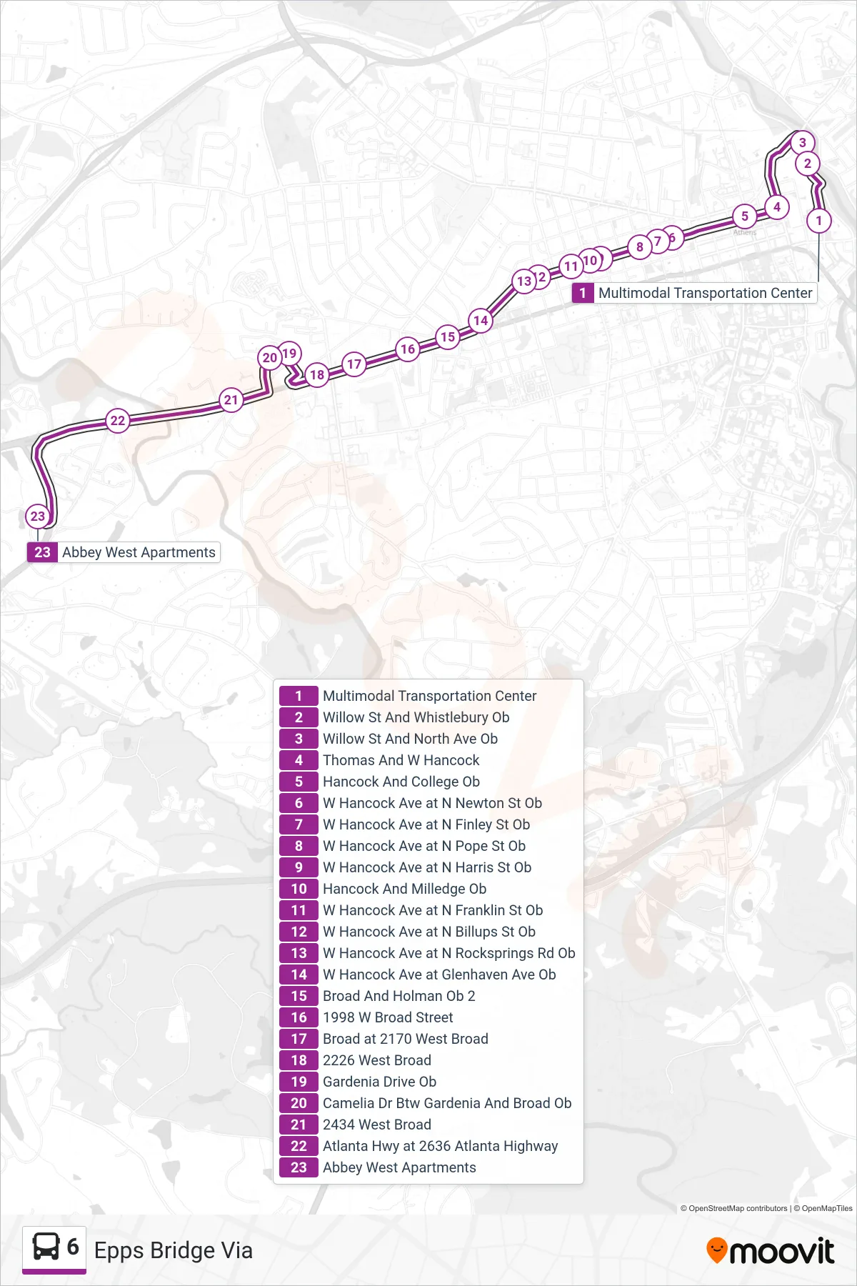
Stops list (6 - Epps Bridge Via)
- Multimodal Transportation Center
- Willow St And Whistlebury Ob
- Willow St And North Ave Ob
- Thomas And W Hancock
- Hancock And College Ob
- W Hancock Ave at N Newton St Ob
- W Hancock Ave at N Finley St Ob
- W Hancock Ave at N Pope St Ob
- W Hancock Ave at N Harris St Ob
- Hancock And Milledge Ob
- W Hancock Ave at N Franklin St Ob
- W Hancock Ave at N Billups St Ob
- W Hancock Ave at N Rocksprings Rd Ob
- W Hancock Ave at Glenhaven Ave Ob
- Broad And Holman Ob 2
- 1998 W Broad Street
- Broad at 2170 West Broad
- 2226 West Broad
- Gardenia Drive Ob
- Camelia Dr Btw Gardenia And Broad Ob
- 2434 West Broad
- Atlanta Hwy at 2636 Atlanta Highway
- Abbey West Apartments