
6 Bus Route Map
View the 6 route map and see all 6 stops along the route. The map of 6 shows where the bus travels and the location of each stop, making it easy to understand the entire route at a glance.
Explore Space Coast Area Transit routes on the map and see where Space Coast Area Transit bus services operate. Use the 6 map to find bus stops and see how the 6 connects different areas along its trip.
All 6 stops on the map are displayed in route order, helping you follow the 6 bus from the first stop to the last.
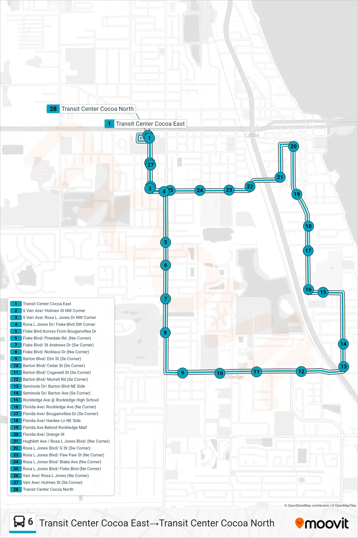
Stops list (6 - Transit Center Cocoa East→Transit Center Cocoa North)
- Transit Center Cocoa East
- S Varr Ave/ Holmes St NW Corner
- S Varr Ave/ Rosa L Jones Dr NW Corner
- Rosa L Jones Dr/ Fiske Blvd SW Corner
- Fiske Blvd Across From Bouganvillea Dr
- Fiske Blvd/ Pinedale Rd. (Nw Corner)
- Fiske Blvd/ St Andrews Dr (Sw Corner)
- Fiske Blvd/ Nicklaus Dr (Nw Corner)
- Barton Blvd/ Elm St (Se Corner)
- Barton Blvd/ Cedar St (Se Corner)
- Barton Blvd/ Cogswell St (Se Corner)
- Barton Blvd/ Murrell Rd (Se Corner)
- Seminole Dr/ Barton Blvd NE Side
- Seminole Dr/ Barton Ave (Se Corner)
- Rockledge Ave @ Rockledge High School
- Florida Ave/ Rockledge Ave (Ne Corner)
- Florida Ave/ Bougainvillea Dr (Se Corner)
- Florida Ave/ Hardee Ln NE Side
- Florida Ave Behind Rockledge Mall
- Florida Ave/ Orange St
- Hughlett Ave / Rosa L Jones Blvd/ (Nw Corner)
- Rosa L Jones Blvd/ G St (Sw Corner)
- Rosa L Jones Blvd/ Paw Paw St (Ne Corner)
- Rosa L Jones Blvd/ Blake Ave (Nw Corner)
- Rosa L Jones Blvd/ Fiske Blvd (Ne Corner)
- Varr Ave/ Rosa L Jones (Ne Corner)
- Varr Ave/ Holmes St (Se Corner)
- Transit Center Cocoa North