
6 Bus Route Map
View the 6 route map and see all 6 stops along the route. The map of 6 shows where the bus travels and the location of each stop, making it easy to understand the entire route at a glance.
Explore Livorno and Province - Tuscan Bus Lines routes on the map and see where Livorno and Province - Tuscan Bus Lines bus services operate. Use the 6 map to find bus stops and see how the 6 connects different areas along its trip.
All 6 stops on the map are displayed in route order, helping you follow the 6 bus from the first stop to the last.
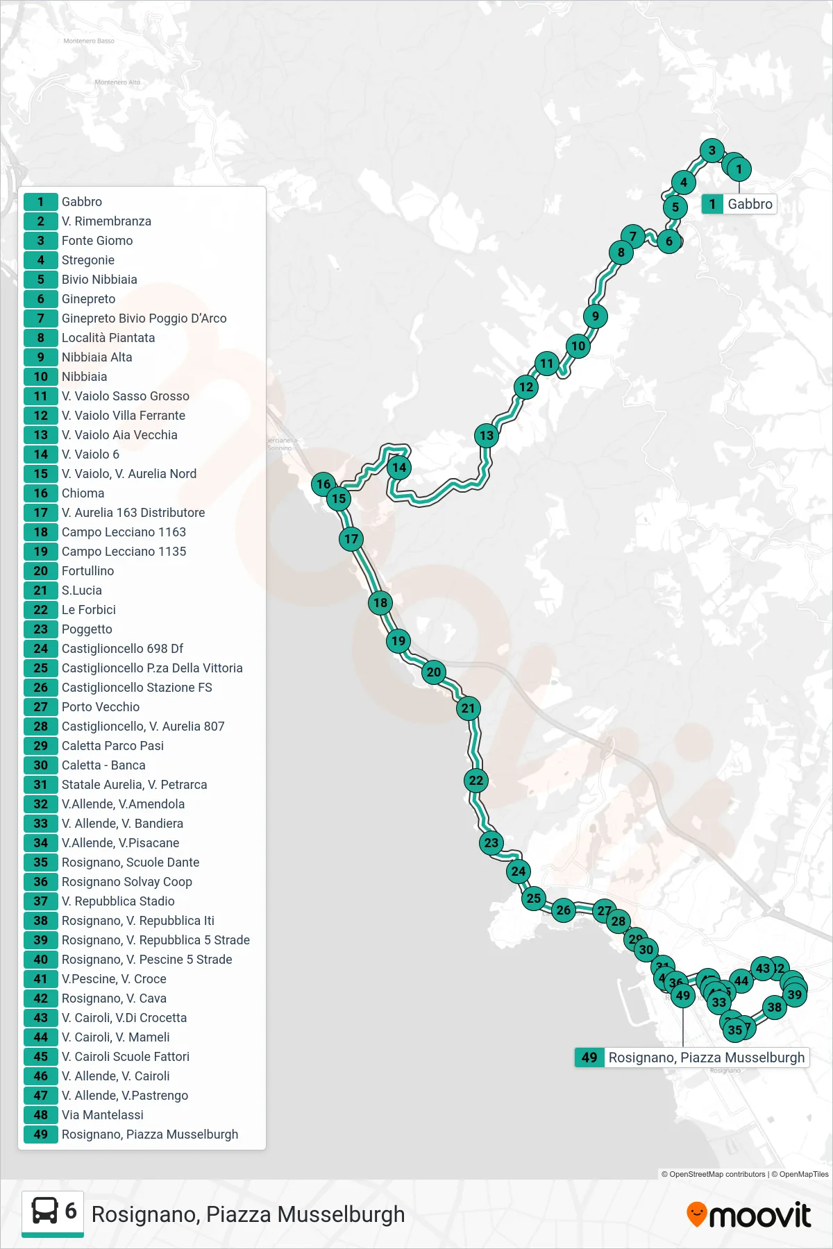
Stops list (6 - Rosignano, Musselburgh Square)
- Gabbro
- Via Rimembranza
- Fonte Giomo
- Stregonie
- Nibbiaia Junction
- Ginepreto
- Ginepreto Junction Poggio D'Arco
- Piantata Location
- Upper Nibbiaia
- Nibbiaia
- Via Vaiolo Sasso Grosso
- Via Vaiolo Villa Ferrante
- Via Vaiolo Old Threshing Floor
- V. Vaiolo 6
- Via Vaiolo, North Aurelia Road
- Chioma
- Aurelia Road 163 Gas Station
- Campo Lecciano 1163
- Campo Lecciano 1135
- Fortullino
- S.Lucia
- The Scissors
- Poggetto
- Castiglioncello 698 Df
- Castiglioncello Victory Square
- Castiglioncello Railway Station
- Old Port
- Castiglioncello, 807 Aurelia Road
- Caletta Pasi Park
- Caletta - Bank
- State Road Aurelia, Petrarca St
- Allende Street, Amendola Street
- Allende Road, Bandiera Road
- Allende St, Pisacane St
- Rosignano, Dante Schools
- Rosignano Solvay Coop
- Republic Street Stadium
- Rosignano, Republic Street ITI
- Rosignano, Repubblica St. 5 Roads
- Rosignano, 5 Streets Pescine Road
- Via Pescine, Via Croce
- Rosignano, Cava Street
- Via Cairoli, Via Di Crocetta
- Cairoli Street, Mameli Street
- V. Cairoli Fattori Schools
- Allende St, Cairoli St
- Allende and Pastrengo Streets
- Via Mantelassi
- Rosignano, Musselburgh Square