
6 Bus Route Map
View the 6 route map and see all 6 stops along the route. The map of 6 shows where the bus travels and the location of each stop, making it easy to understand the entire route at a glance.
Explore Bus Átha Cliath – Dublin Bus routes on the map and see where Bus Átha Cliath – Dublin Bus bus services operate. Use the 6 map to find bus stops and see how the 6 connects different areas along its trip.
All 6 stops on the map are displayed in route order, helping you follow the 6 bus from the first stop to the last.
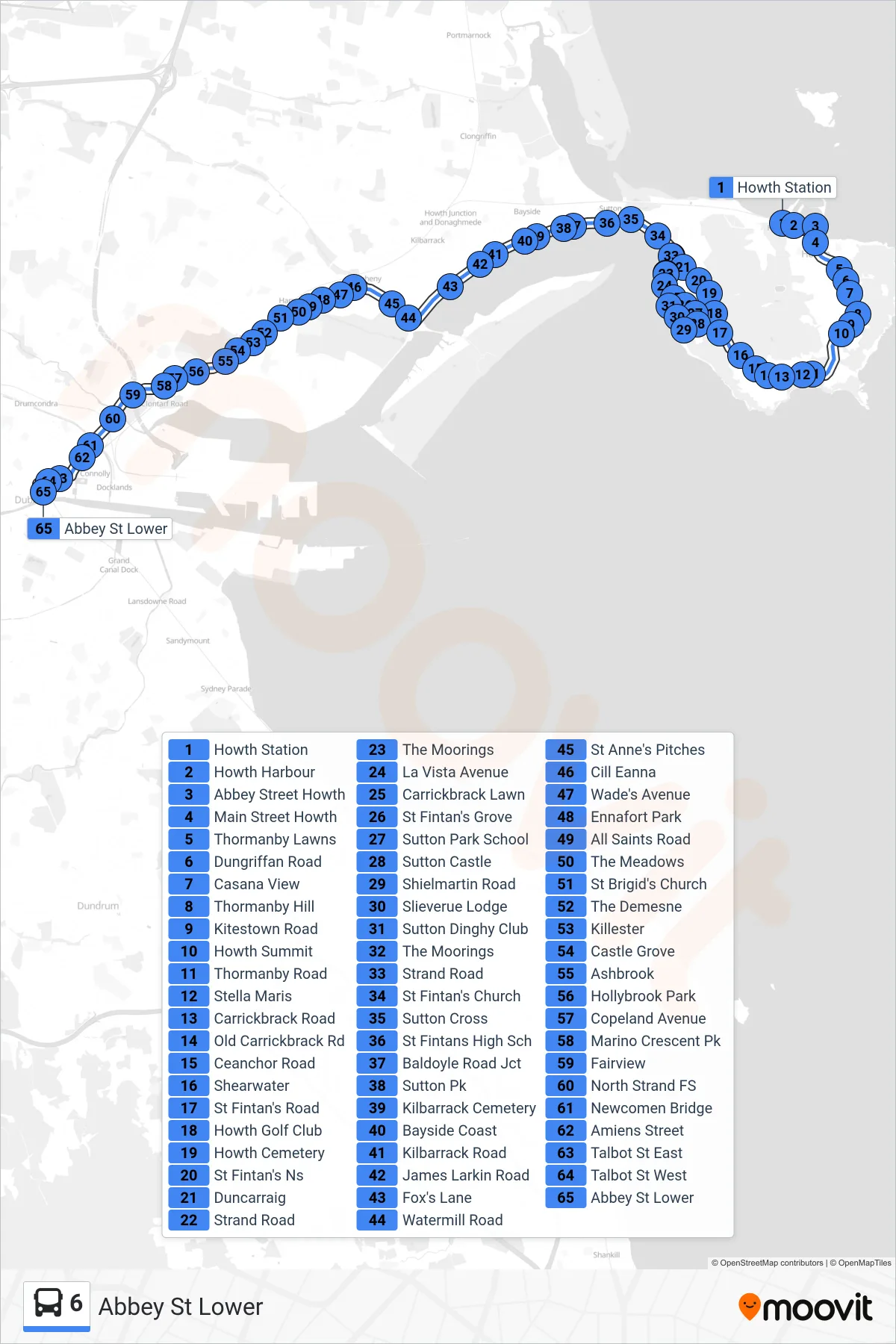
Stops list (6 - Abbey St Lower)
- Howth Station
- Howth Harbour
- Abbey Street Howth
- Main Street Howth
- Thormanby Lawns
- Dungriffan Road
- Casana View
- Thormanby Hill
- Kitestown Road
- Howth Summit
- Thormanby Road
- Stella Maris
- Carrickbrack Road
- Old Carrickbrack Rd
- Ceanchor Road
- Shearwater
- St Fintan's Road
- Howth Golf Club
- Howth Cemetery
- St Fintan's Ns
- Duncarraig
- Strand Road
- The Moorings
- La Vista Avenue
- Carrickbrack Lawn
- St Fintan's Grove
- Sutton Park School
- Sutton Castle
- Shielmartin Road
- Slieverue Lodge
- Sutton Dinghy Club
- The Moorings
- Strand Road
- St Fintan's Church
- Sutton Cross
- St Fintans High Sch
- Baldoyle Road Jct
- Sutton Pk
- Kilbarrack Cemetery
- Bayside Coast
- Kilbarrack Road
- James Larkin Road
- Fox's Lane
- Watermill Road
- St Anne's Pitches
- Cill Eanna
- Wade's Avenue
- Ennafort Park
- All Saints Road
- The Meadows
- St Brigid's Church
- The Demesne
- Killester
- Castle Grove
- Ashbrook
- Hollybrook Park
- Copeland Avenue
- Marino Crescent Pk
- Fairview
- North Strand FS
- Newcomen Bridge
- Amiens Street
- Talbot St East
- Talbot St West
- Abbey St Lower