
6 Bus Route Map
View the 6 route map and see all 6 stops along the route. The map of 6 shows where the bus travels and the location of each stop, making it easy to understand the entire route at a glance.
Explore KP Kyivpastrans routes on the map and see where KP Kyivpastrans bus services operate. Use the 6 map to find bus stops and see how the 6 connects different areas along its trip.
All 6 stops on the map are displayed in route order, helping you follow the 6 bus from the first stop to the last.
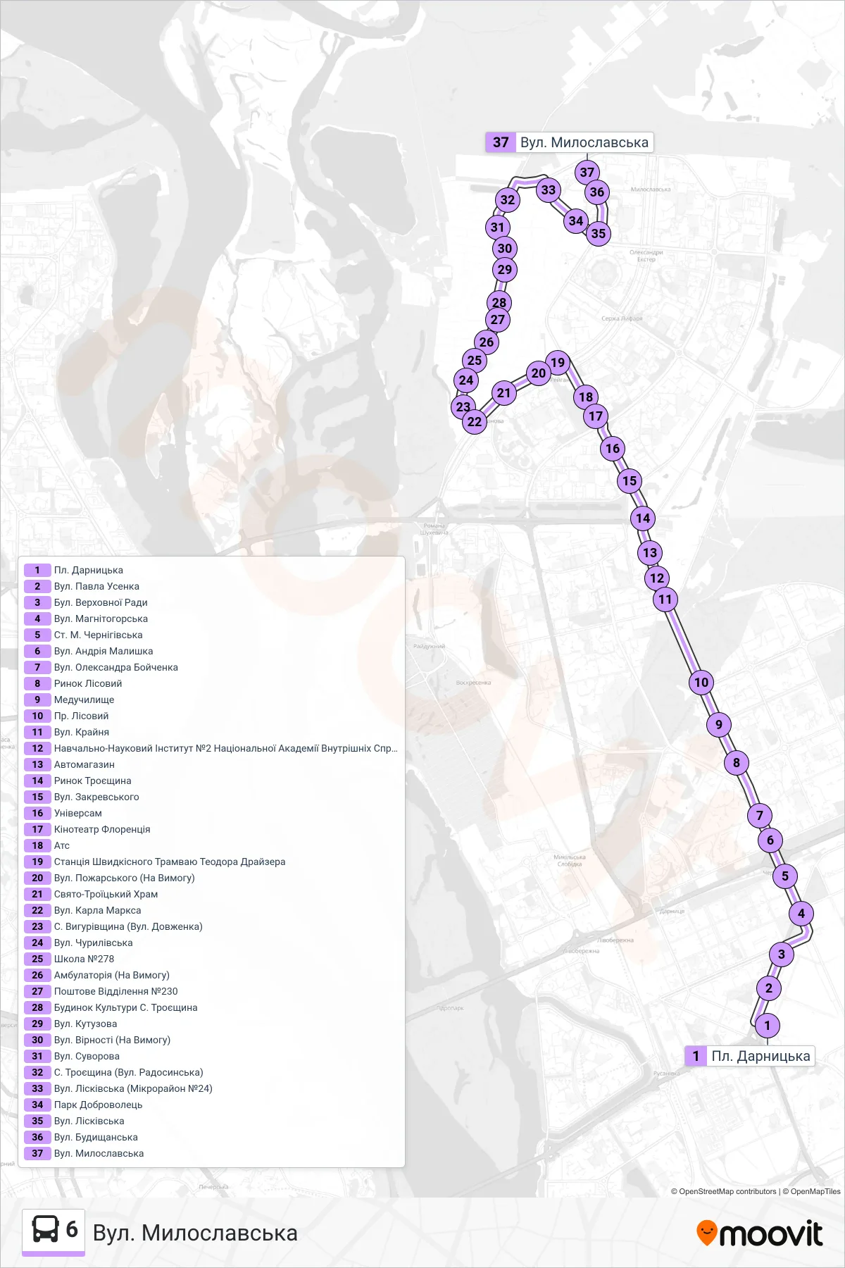
Stops list (6 - Myloslavska St.)
- Darnytska Square
- Pavla Usenka St
- Verkhovnoi Rady Blvd
- Mahnitohorska Street
- Chernihivska Metro Station
- Andriy Malyshko Street
- Oleksandra Boichenka Street
- Lisovyi Market
- Medical College
- Lisovyi Avenue
- Krainya St
- Educational-Scientific Institute #2 of National Academy of Internal Affairs
- Auto Store
- Troieshchyna Market
- Zakrevskoho St.
- Universam
- Florence Cinema
- Ats
- Theodor Dreiser Speed Tram Station
- Pozharskyi St (On Request)
- Holy Trinity Church
- Karl Marx St.
- Vyhurivshchyna Village (Dovzhenko Street)
- Churylivska Street
- School No. 278
- Medical Clinic (On Request)
- Post Office #230
- Troieshchyna Village Cultural Center
- Kutuzova Street
- Virnosti Street (On Demand)
- Suvorova Street
- Troieshchyna Village (Radosynska Street)
- Liskivska St (Microdistrict 24)
- Dobrovolets Park
- Liskivska St
- Budyshchanska St
- Myloslavska St.