
6 Bus Route Map
View the 6 route map and see all 6 stops along the route. The map of 6 shows where the bus travels and the location of each stop, making it easy to understand the entire route at a glance.
Explore Hanauer Straßenbahn GmbH routes on the map and see where Hanauer Straßenbahn GmbH bus services operate. Use the 6 map to find bus stops and see how the 6 connects different areas along its trip.
All 6 stops on the map are displayed in route order, helping you follow the 6 bus from the first stop to the last.
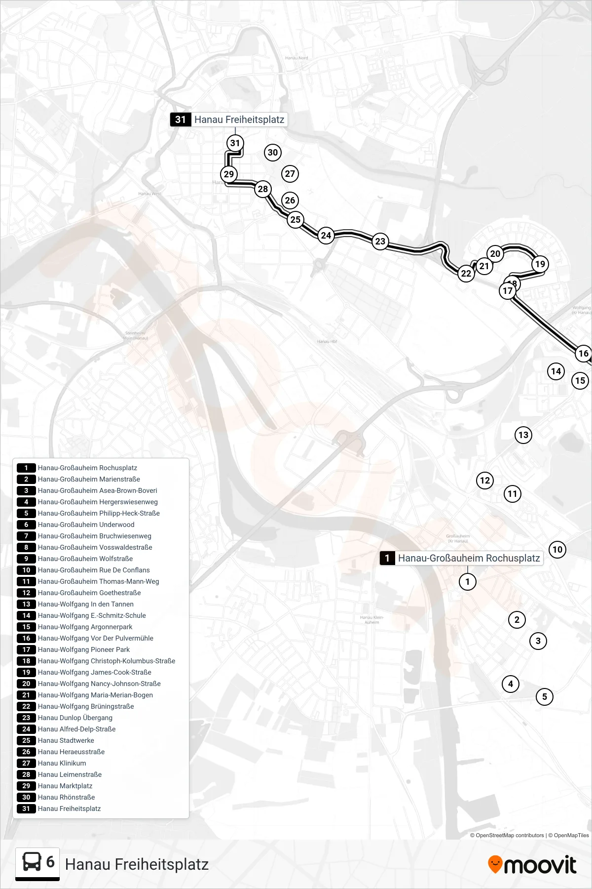
Stops list (6 - Hanau Freiheitsplatz)
- Hanau-Großauheim Rochusplatz
- Hanau-Großauheim Marienstraße
- Hanau-Großauheim Asea-Brown-Boveri
- Hanau-Großauheim Hergerswiesenweg
- Hanau-Großauheim Philipp-Heck-Straße
- Hanau-Großauheim Underwood
- Hanau-Großauheim Bruchwiesenweg
- Hanau-Großauheim Vosswaldestraße
- Hanau-Großauheim Wolfstraße
- Hanau-Großauheim Rue De Conflans
- Hanau-Großauheim Thomas-Mann-Weg
- Hanau-Großauheim Goethestraße
- Hanau-Wolfgang In den Tannen
- Hanau-Wolfgang E.-Schmitz-Schule
- Hanau-Wolfgang Argonnerpark
- Hanau-Wolfgang Vor Der Pulvermühle
- Hanau-Wolfgang Pioneer Park
- Hanau-Wolfgang Christoph-Kolumbus-Straße
- Hanau-Wolfgang James-Cook-Straße
- Hanau-Wolfgang Nancy-Johnson-Straße
- Hanau-Wolfgang Maria-Merian-Bogen
- Hanau-Wolfgang Brüningstraße
- Hanau Dunlop Übergang
- Hanau Alfred-Delp-Straße
- Hanau Stadtwerke
- Hanau Heraeusstraße
- Hanau Klinikum
- Hanau Leimenstraße
- Hanau Marktplatz
- Hanau Rhönstraße
- Hanau Freiheitsplatz