
6 Bus Route Map
View the 6 route map and see all 6 stops along the route. The map of 6 shows where the bus travels and the location of each stop, making it easy to understand the entire route at a glance.
Explore Koblenzer Verkehrsbetriebe GmbH routes on the map and see where Koblenzer Verkehrsbetriebe GmbH bus services operate. Use the 6 map to find bus stops and see how the 6 connects different areas along its trip.
All 6 stops on the map are displayed in route order, helping you follow the 6 bus from the first stop to the last.
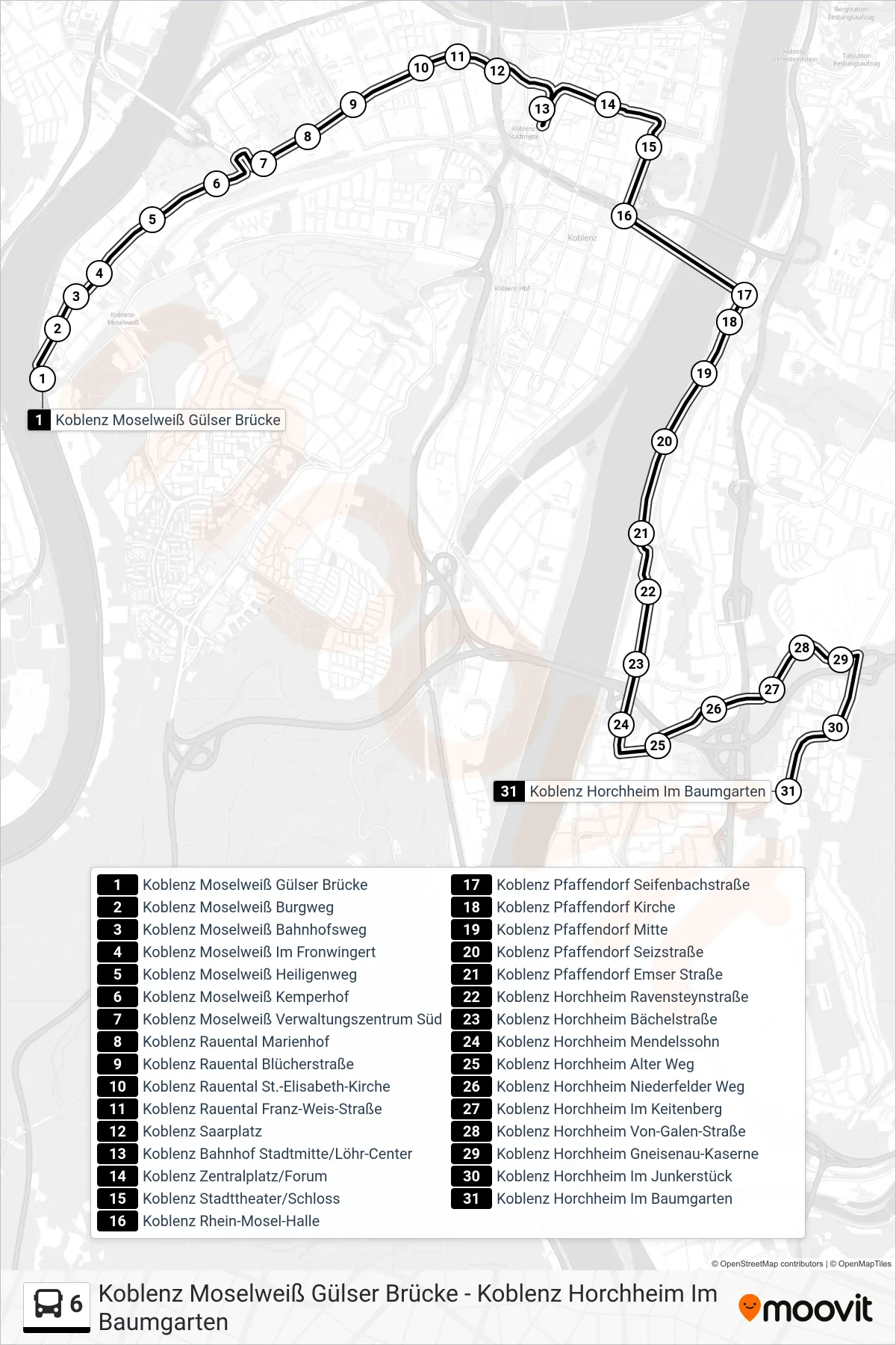
Stops list (6 - Koblenz Horchheim Im Baumgarten)
- Koblenz Moselweiß Gülser Brücke
- Koblenz Moselweiß Burgweg
- Koblenz Moselweiß Bahnhofsweg
- Koblenz Moselweiß Im Fronwingert
- Koblenz Moselweiß Heiligenweg
- Koblenz Moselweiß Kemperhof
- Koblenz Moselweiß Verwaltungszentrum Süd
- Koblenz Rauental Marienhof
- Koblenz Rauental Blücherstraße
- Koblenz Rauental St.-Elisabeth-Kirche
- Koblenz Rauental Franz-Weis-Straße
- Koblenz Saarplatz
- Koblenz Bahnhof Stadtmitte/Löhr-Center
- Koblenz Zentralplatz/Forum
- Koblenz Stadttheater/Schloss
- Koblenz Rhein-Mosel-Halle
- Koblenz Pfaffendorf Seifenbachstraße
- Koblenz Pfaffendorf Kirche
- Koblenz Pfaffendorf Mitte
- Koblenz Pfaffendorf Seizstraße
- Koblenz Pfaffendorf Emser Straße
- Koblenz Horchheim Ravensteynstraße
- Koblenz Horchheim Bächelstraße
- Koblenz Horchheim Mendelssohn
- Koblenz Horchheim Alter Weg
- Koblenz Horchheim Niederfelder Weg
- Koblenz Horchheim Im Keitenberg
- Koblenz Horchheim Von-Galen-Straße
- Koblenz Horchheim Gneisenau-Kaserne
- Koblenz Horchheim Im Junkerstück
- Koblenz Horchheim Im Baumgarten