
6 Bus Route Map
View the 6 route map and see all 6 stops along the route. The map of 6 shows where the bus travels and the location of each stop, making it easy to understand the entire route at a glance.
Explore RRReis routes on the map and see where RRReis bus services operate. Use the 6 map to find bus stops and see how the 6 connects different areas along its trip.
All 6 stops on the map are displayed in route order, helping you follow the 6 bus from the first stop to the last.
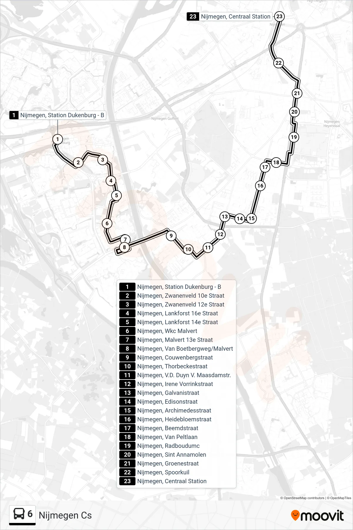
Stops list (6 - Nijmegen Cs)
- Nijmegen, Station Dukenburg - B
- Nijmegen, Zwanenveld 10e Straat
- Nijmegen, Zwanenveld 12e Straat
- Nijmegen, Lankforst 16e Straat
- Nijmegen, Lankforst 14e Straat
- Nijmegen, Wkc Malvert
- Nijmegen, Malvert 13e Straat
- Nijmegen, Van Boetbergweg/Malvert
- Nijmegen, Couwenbergstraat
- Nijmegen, Thorbeckestraat
- Nijmegen, V.D. Duyn V. Maasdamstr.
- Nijmegen, Irene Vorrinkstraat
- Nijmegen, Galvanistraat
- Nijmegen, Edisonstraat
- Nijmegen, Archimedesstraat
- Nijmegen, Heidebloemstraat
- Nijmegen, Beemdstraat
- Nijmegen, Van Peltlaan
- Nijmegen, Radboudumc
- Nijmegen, Sint Annamolen
- Nijmegen, Groenestraat
- Nijmegen, Spoorkuil
- Nijmegen, Centraal Station