
6 Bus Route Map
View the 6 route map and see all 6 stops along the route. The map of 6 shows where the bus travels and the location of each stop, making it easy to understand the entire route at a glance.
Explore SEPTA routes on the map and see where SEPTA bus services operate. Use the 6 map to find bus stops and see how the 6 connects different areas along its trip.
All 6 stops on the map are displayed in route order, helping you follow the 6 bus from the first stop to the last.
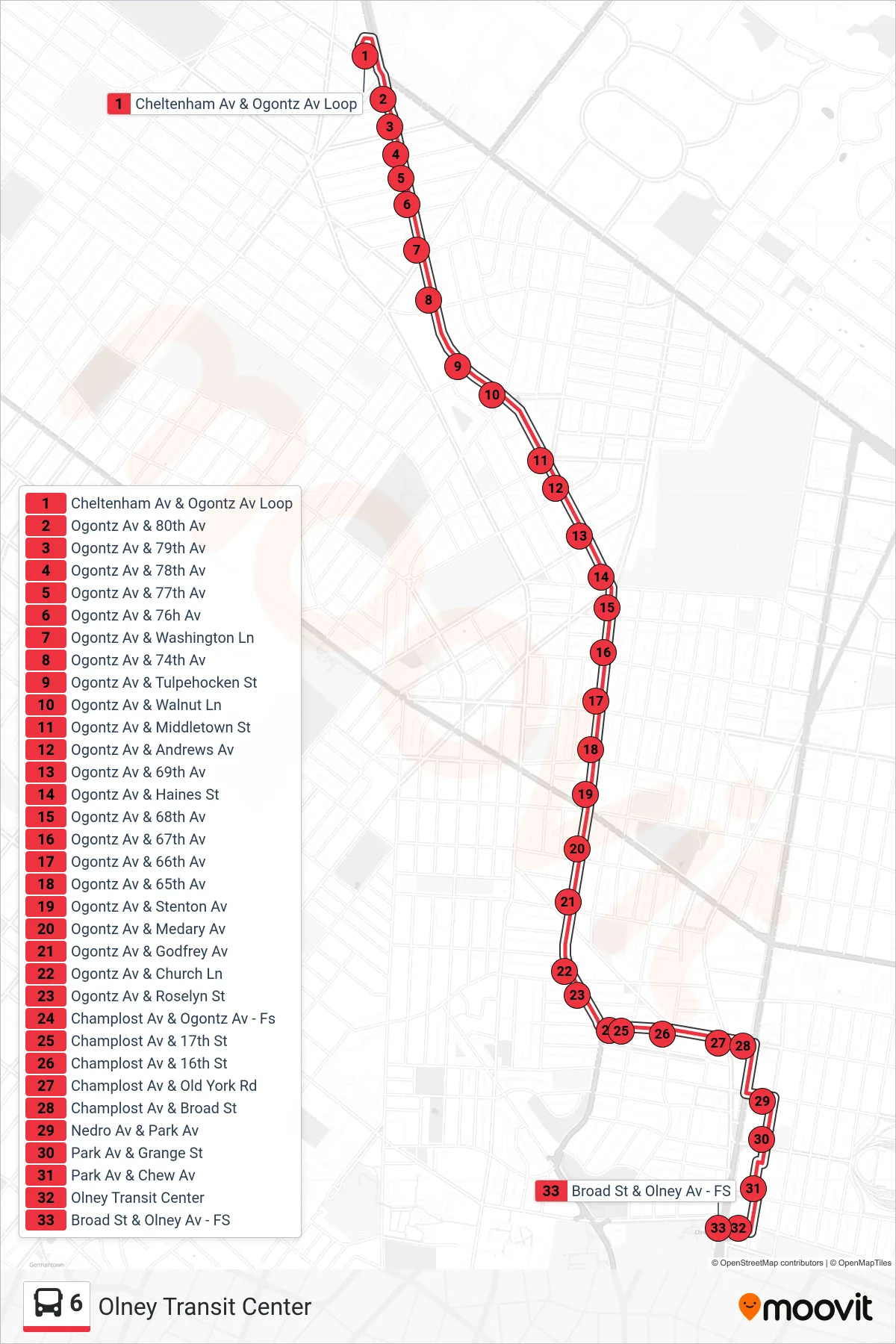
Stops list (6 - Olney Transit Center)
- Cheltenham Av & Ogontz Av Loop
- Ogontz Av & 80th Av
- Ogontz Av & 79th Av
- Ogontz Av & 78th Av
- Ogontz Av & 77th Av
- Ogontz Av & 76h Av
- Ogontz Av & Washington Ln
- Ogontz Av & 74th Av
- Ogontz Av & Tulpehocken St
- Ogontz Av & Walnut Ln
- Ogontz Av & Middletown St
- Ogontz Av & Andrews Av
- Ogontz Av & 69th Av
- Ogontz Av & Haines St
- Ogontz Av & 68th Av
- Ogontz Av & 67th Av
- Ogontz Av & 66th Av
- Ogontz Av & 65th Av
- Ogontz Av & Stenton Av
- Ogontz Av & Medary Av
- Ogontz Av & Godfrey Av
- Ogontz Av & Church Ln
- Ogontz Av & Roselyn St
- Champlost Av & Ogontz Av - Fs
- Champlost Av & 17th St
- Champlost Av & 16th St
- Champlost Av & Old York Rd
- Champlost Av & Broad St
- Nedro Av & Park Av
- Park Av & Grange St
- Park Av & Chew Av
- Olney Transit Center
- Broad St & Olney Av - FS