
6 Bus Route Map
View the 6 route map and see all 6 stops along the route. The map of 6 shows where the bus travels and the location of each stop, making it easy to understand the entire route at a glance.
Explore Aachener Straßenbahn- und Energieversorgungs-AG routes on the map and see where Aachener Straßenbahn- und Energieversorgungs-AG bus services operate. Use the 6 map to find bus stops and see how the 6 connects different areas along its trip.
All 6 stops on the map are displayed in route order, helping you follow the 6 bus from the first stop to the last.
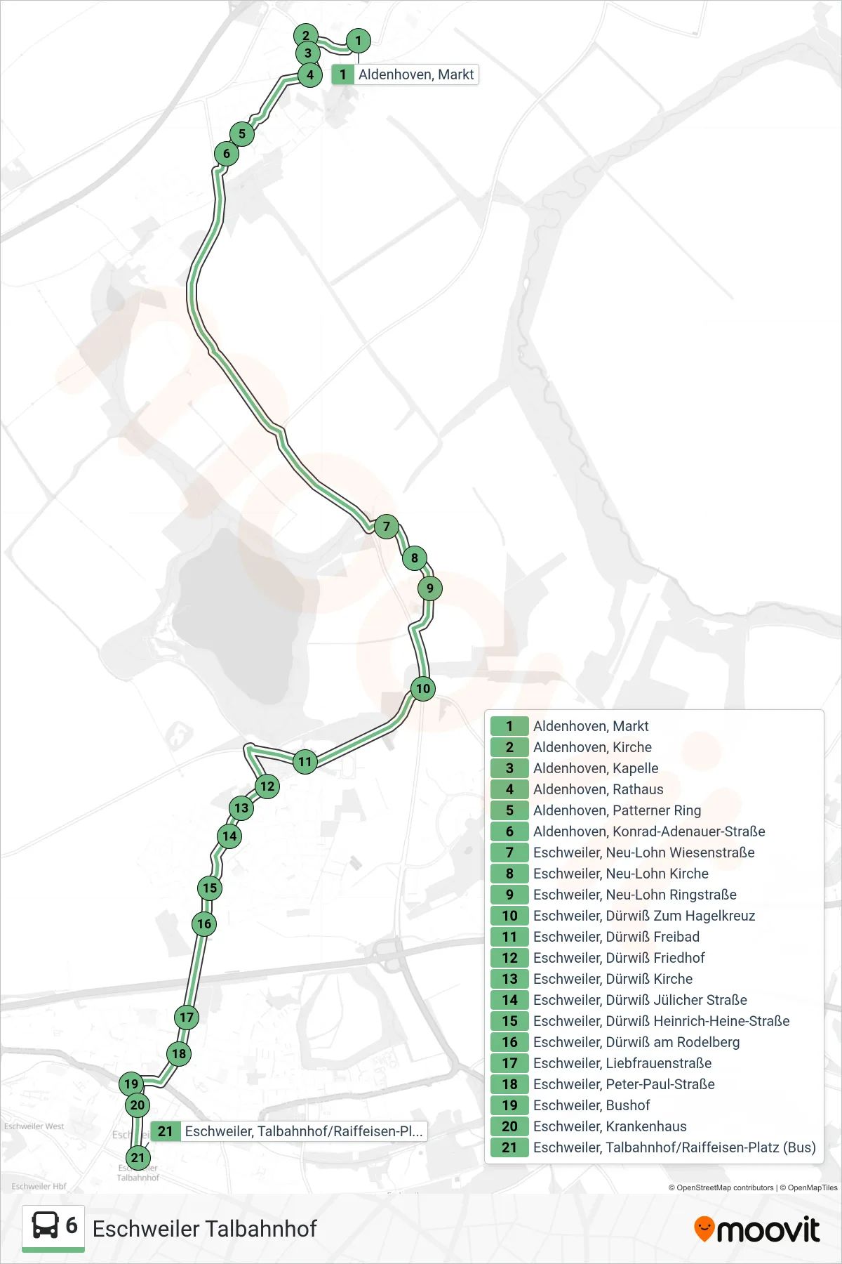
Stops list (6 - Eschweiler Talbahnhof)
- Aldenhoven, Markt
- Aldenhoven, Kirche
- Aldenhoven, Kapelle
- Aldenhoven, Rathaus
- Aldenhoven, Patterner Ring
- Aldenhoven, Konrad-Adenauer-Straße
- Eschweiler, Neu-Lohn Wiesenstraße
- Eschweiler, Neu-Lohn Kirche
- Eschweiler, Neu-Lohn Ringstraße
- Eschweiler, Dürwiß Zum Hagelkreuz
- Eschweiler, Dürwiß Freibad
- Eschweiler, Dürwiß Friedhof
- Eschweiler, Dürwiß Kirche
- Eschweiler, Dürwiß Jülicher Straße
- Eschweiler, Dürwiß Heinrich-Heine-Straße
- Eschweiler, Dürwiß am Rodelberg
- Eschweiler, Liebfrauenstraße
- Eschweiler, Peter-Paul-Straße
- Eschweiler, Bushof
- Eschweiler, Krankenhaus
- Eschweiler, Talbahnhof/Raiffeisen-Platz (Bus)
Change direction
- Route Map - 6 - Eschweiler Bushof
- Route Map - 6 - Aldenhoven Markt
- Route Map - 6 - Eschweiler, Neu-Lohn Wiesenstraße
- Route Map - 6 - Jülich, Bahnhof / Zob (Bus)
- Route Map - 6 - Aldenhoven, Markt
- Route Map - 6 - Dürwiß
- Route Map - 6 - Eschweiler, Talbahnhof/Raiffeisen-Platz (Bus)
- Route Map - 6 - Aldenhoven, Kapelle
- Route Map - 6 - Neu-Lohn Wiesenstraße
- Route Map - 6 - Niedermerz Weiler-Hausen
- Route Map - 6 - Eschweiler, Bushof