
6 Bus Route Map
View the 6 route map and see all 6 stops along the route. The map of 6 shows where the bus travels and the location of each stop, making it easy to understand the entire route at a glance.
Explore Stadtwerke Münster GmbH routes on the map and see where Stadtwerke Münster GmbH bus services operate. Use the 6 map to find bus stops and see how the 6 connects different areas along its trip.
All 6 stops on the map are displayed in route order, helping you follow the 6 bus from the first stop to the last.
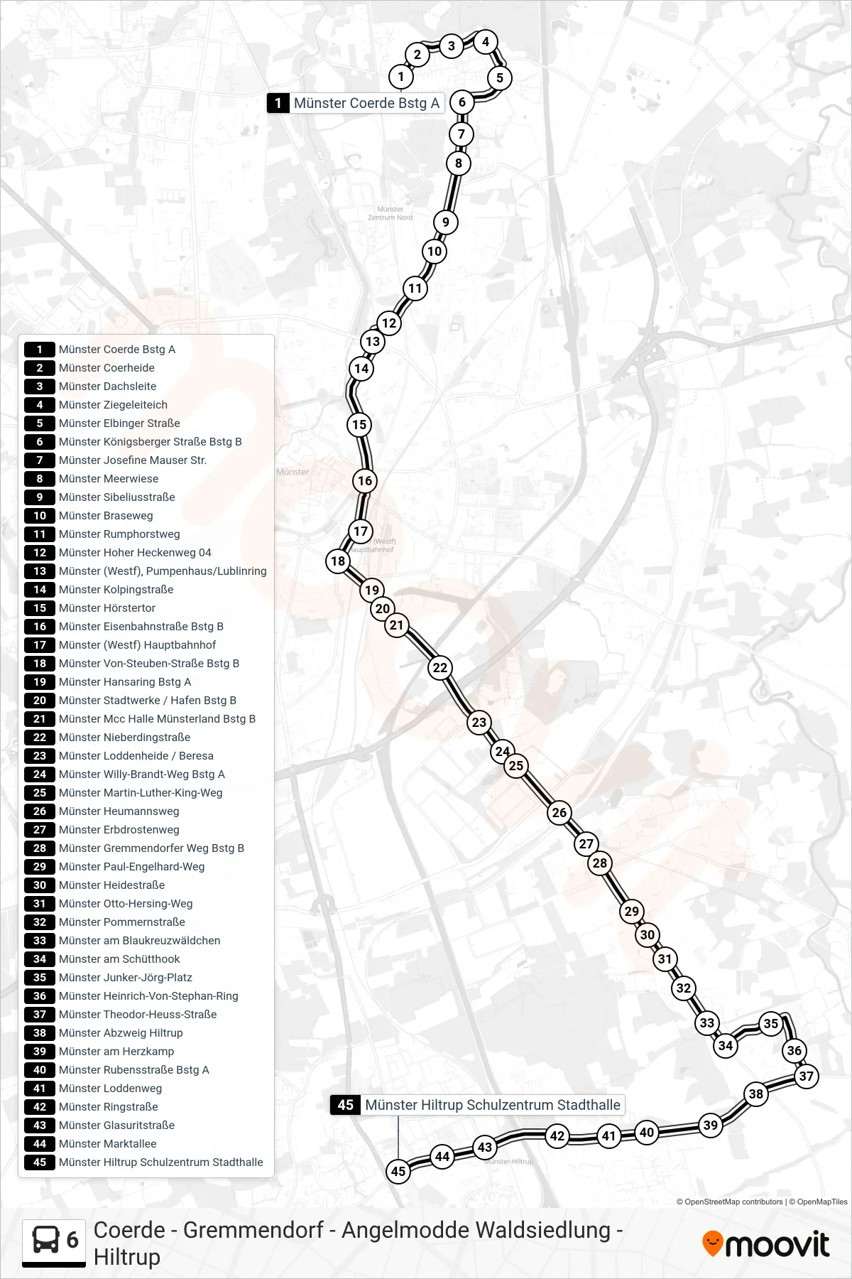
Stops list (6 - Hiltrup Schulzentrum)
- Münster Coerde Bstg A
- Münster Coerheide
- Münster Dachsleite
- Münster Ziegeleiteich
- Münster Elbinger Straße
- Münster Königsberger Straße Bstg B
- Münster Josefine Mauser Str.
- Münster Meerwiese
- Münster Sibeliusstraße
- Münster Braseweg
- Münster Rumphorstweg
- Münster Hoher Heckenweg 04
- Münster (Westf), Pumpenhaus/Lublinring
- Münster Kolpingstraße
- Münster Hörstertor
- Münster Eisenbahnstraße Bstg B
- Münster (Westf) Hauptbahnhof
- Münster Von-Steuben-Straße Bstg B
- Münster Hansaring Bstg A
- Münster Stadtwerke / Hafen Bstg B
- Münster Mcc Halle Münsterland Bstg B
- Münster Nieberdingstraße
- Münster Loddenheide / Beresa
- Münster Willy-Brandt-Weg Bstg A
- Münster Martin-Luther-King-Weg
- Münster Heumannsweg
- Münster Erbdrostenweg
- Münster Gremmendorfer Weg Bstg B
- Münster Paul-Engelhard-Weg
- Münster Heidestraße
- Münster Otto-Hersing-Weg
- Münster Pommernstraße
- Münster am Blaukreuzwäldchen
- Münster am Schütthook
- Münster Junker-Jörg-Platz
- Münster Heinrich-Von-Stephan-Ring
- Münster Theodor-Heuss-Straße
- Münster Abzweig Hiltrup
- Münster am Herzkamp
- Münster Rubensstraße Bstg A
- Münster Loddenweg
- Münster Ringstraße
- Münster Glasuritstraße
- Münster Marktallee
- Münster Hiltrup Schulzentrum Stadthalle