
6 Bus Route Map
View the 6 route map and see all 6 stops along the route. The map of 6 shows where the bus travels and the location of each stop, making it easy to understand the entire route at a glance.
Explore MUNI routes on the map and see where MUNI bus services operate. Use the 6 map to find bus stops and see how the 6 connects different areas along its trip.
All 6 stops on the map are displayed in route order, helping you follow the 6 bus from the first stop to the last.
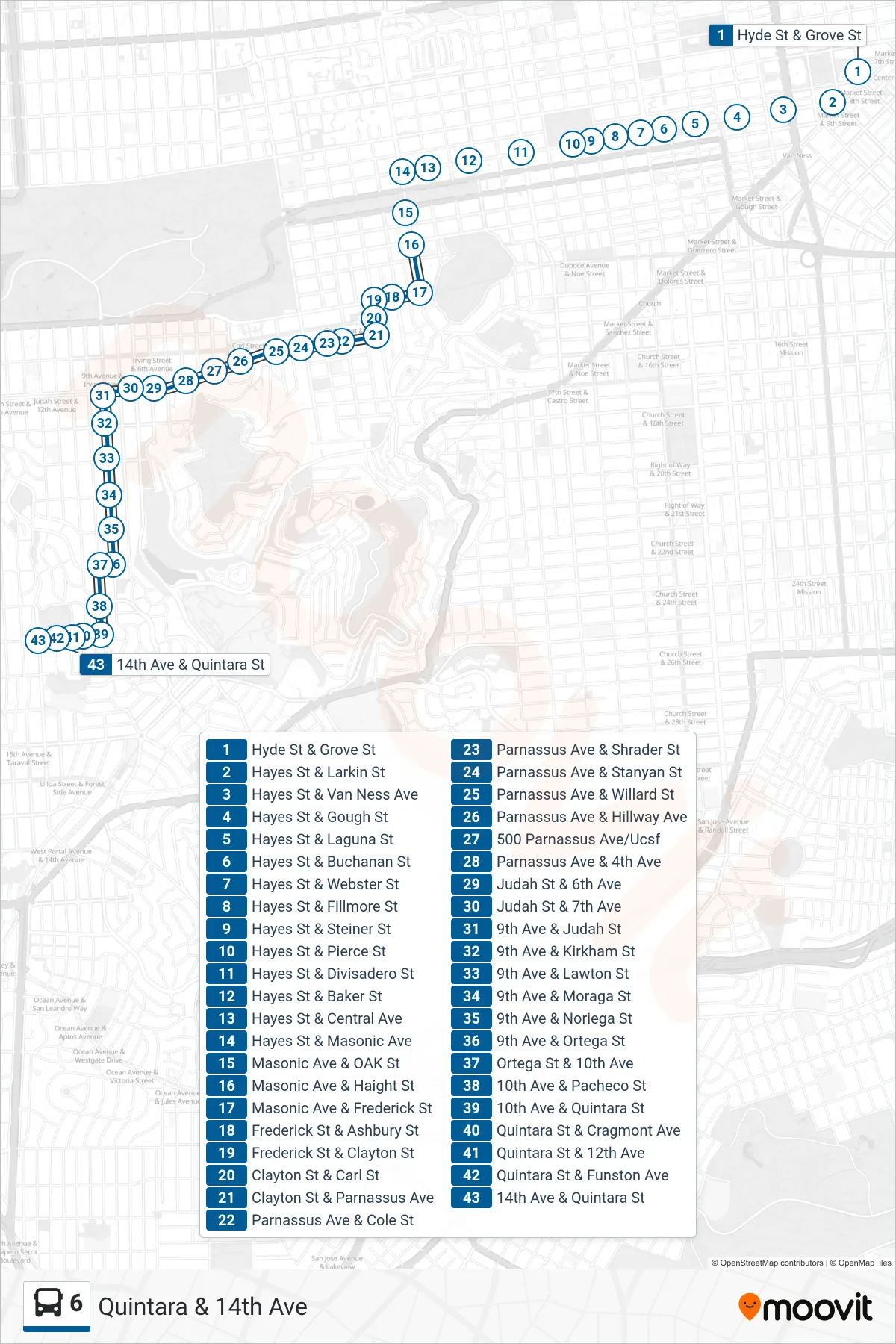
Stops list (6 - Quintara & 14th Ave)
- Hyde St & Grove St
- Hayes St & Larkin St
- Hayes St & Van Ness Ave
- Hayes St & Gough St
- Hayes St & Laguna St
- Hayes St & Buchanan St
- Hayes St & Webster St
- Hayes St & Fillmore St
- Hayes St & Steiner St
- Hayes St & Pierce St
- Hayes St & Divisadero St
- Hayes St & Baker St
- Hayes St & Central Ave
- Hayes St & Masonic Ave
- Masonic Ave & OAK St
- Masonic Ave & Haight St
- Masonic Ave & Frederick St
- Frederick St & Ashbury St
- Frederick St & Clayton St
- Clayton St & Carl St
- Clayton St & Parnassus Ave
- Parnassus Ave & Cole St
- Parnassus Ave & Shrader St
- Parnassus Ave & Stanyan St
- Parnassus Ave & Willard St
- Parnassus Ave & Hillway Ave
- 500 Parnassus Ave/Ucsf
- Parnassus Ave & 4th Ave
- Judah St & 6th Ave
- Judah St & 7th Ave
- 9th Ave & Judah St
- 9th Ave & Kirkham St
- 9th Ave & Lawton St
- 9th Ave & Moraga St
- 9th Ave & Noriega St
- 9th Ave & Ortega St
- Ortega St & 10th Ave
- 10th Ave & Pacheco St
- 10th Ave & Quintara St
- Quintara St & Cragmont Ave
- Quintara St & 12th Ave
- Quintara St & Funston Ave
- 14th Ave & Quintara St