
6 Bus Route Map
View the 6 route map and see all 6 stops along the route. The map of 6 shows where the bus travels and the location of each stop, making it easy to understand the entire route at a glance.
Explore County Connection routes on the map and see where County Connection bus services operate. Use the 6 map to find bus stops and see how the 6 connects different areas along its trip.
All 6 stops on the map are displayed in route order, helping you follow the 6 bus from the first stop to the last.
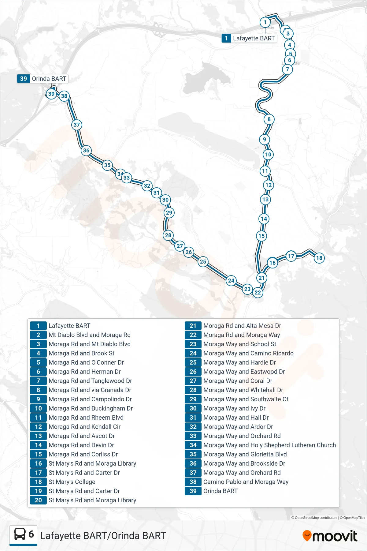
Stops list (6 - Orinda BART via St. Mary's College)
- Lafayette BART
- Mt Diablo Blvd and Moraga Rd
- Moraga Rd and Mt Diablo Blvd
- Moraga Rd and Brook St
- Moraga Rd and O'Conner Dr
- Moraga Rd and Herman Dr
- Moraga Rd and Tanglewood Dr
- Moraga Rd and via Granada Dr
- Moraga Rd and Campolindo Dr
- Moraga Rd and Buckingham Dr
- Moraga Rd and Rheem Blvd
- Moraga Rd and Kendall Cir
- Moraga Rd and Ascot Dr
- Moraga Rd and Devin Dr
- Moraga Rd and Corliss Dr
- St Mary's Rd and Moraga Library
- St Mary's Rd and Carter Dr
- St Mary's College
- St Mary's Rd and Carter Dr
- St Mary's Rd and Moraga Library
- Moraga Rd and Alta Mesa Dr
- Moraga Rd and Moraga Way
- Moraga Way and School St
- Moraga Way and Camino Ricardo
- Moraga Way and Hardie Dr
- Moraga Way and Eastwood Dr
- Moraga Way and Coral Dr
- Moraga Way and Whitehall Dr
- Moraga Way and Southwaite Ct
- Moraga Way and Ivy Dr
- Moraga Way and Hall Dr
- Moraga Way and Ardor Dr
- Moraga Way and Orchard Rd
- Moraga Way and Holy Shepherd Lutheran Church
- Moraga Way and Glorietta Blvd
- Moraga Way and Brookside Dr
- Moraga Way and Orchard Rd
- Camino Pablo and Moraga Way
- Orinda BART