
6 Bus Route Map
View the 6 route map and see all 6 stops along the route. The map of 6 shows where the bus travels and the location of each stop, making it easy to understand the entire route at a glance.
Explore Süd Weil am Rhein Lörrach routes on the map and see where Süd Weil am Rhein Lörrach bus services operate. Use the 6 map to find bus stops and see how the 6 connects different areas along its trip.
All 6 stops on the map are displayed in route order, helping you follow the 6 bus from the first stop to the last.
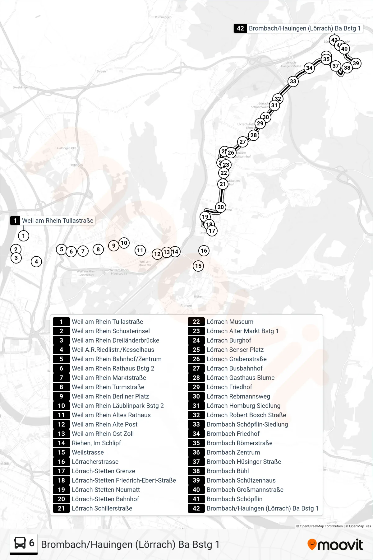
Stops list (6 - Brombach/Hauingen (Lörrach) Ba Bstg 1)
- Weil am Rhein Tullastraße
- Weil am Rhein Schusterinsel
- Weil am Rhein Dreiländerbrücke
- Weil A.R.Riedlistr./Kesselhaus
- Weil am Rhein Bahnhof/Zentrum
- Weil am Rhein Rathaus Bstg 2
- Weil am Rhein Marktstraße
- Weil am Rhein Turmstraße
- Weil am Rhein Berliner Platz
- Weil am Rhein Läublinpark Bstg 2
- Weil am Rhein Altes Rathaus
- Weil am Rhein Alte Post
- Weil am Rhein Ost Zoll
- Riehen, Im Schlipf
- Weilstrasse
- Lörracherstrasse
- Lörrach-Stetten Grenze
- Lörrach-Stetten Friedrich-Ebert-Straße
- Lörrach-Stetten Neumatt
- Lörrach-Stetten Bahnhof
- Lörrach Schillerstraße
- Lörrach Museum
- Lörrach Alter Markt Bstg 1
- Lörrach Burghof
- Lörrach Senser Platz
- Lörrach Grabenstraße
- Lörrach Busbahnhof
- Lörrach Gasthaus Blume
- Lörrach Friedhof
- Lörrach Rebmannsweg
- Lörrach Homburg Siedlung
- Lörrach Robert Bosch Straße
- Brombach Schöpflin-Siedlung
- Brombach Friedhof
- Brombach Römerstraße
- Brombach Zentrum
- Brombach Hüsinger Straße
- Brombach Bühl
- Brombach Schützenhaus
- Brombach Großmannstraße
- Brombach Schöpflin
- Brombach/Hauingen (Lörrach) Ba Bstg 1