
6 Bus Route Map
View the 6 route map and see all 6 stops along the route. The map of 6 shows where the bus travels and the location of each stop, making it easy to understand the entire route at a glance.
Explore GTT Suburban Service routes on the map and see where GTT Suburban Service bus services operate. Use the 6 map to find bus stops and see how the 6 connects different areas along its trip.
All 6 stops on the map are displayed in route order, helping you follow the 6 bus from the first stop to the last.
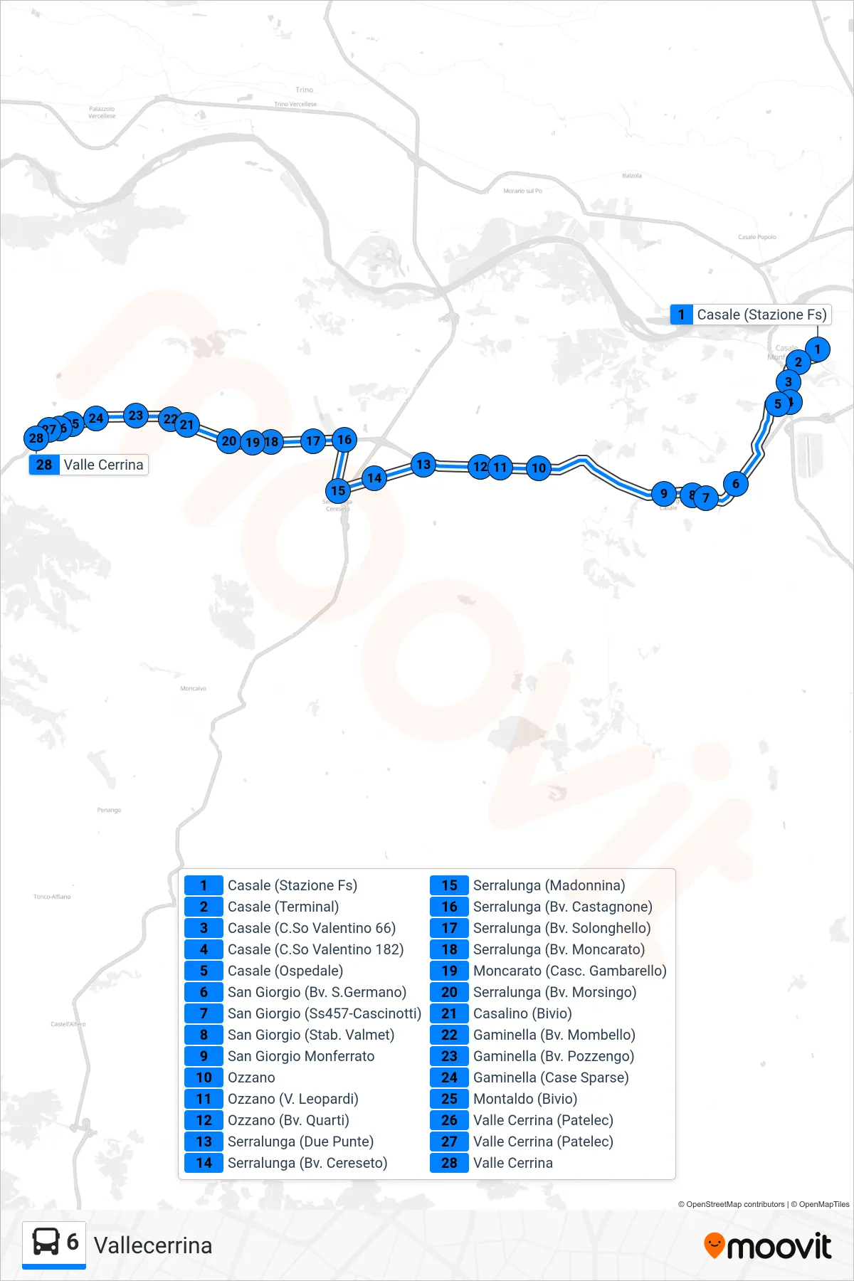
Stops list (6 - Vallecerrina)
- Casale (Railway Station)
- Casale (Terminal)
- Casale (Valentino Avenue 66)
- Casale (Valentino Avenue 182)
- Casale (Hospital)
- San Giorgio (San Germano Junction)
- San Giorgio (State Road 457-Cascinotti)
- San Giorgio (Valmet Factory)
- San Giorgio Monferrato
- Ozzano
- Ozzano (Leopardi St)
- Ozzano (Quarti Junction)
- Serralunga (Two Peaks)
- Serralunga (Cereseto Junction)
- Serralunga (Madonnina)
- Serralunga (Castagnone Junction)
- Serralunga (Solonghello Junction)
- Serralunga (Junction Moncarato)
- Moncarato (Gambarello Farm)
- Serralunga (Morsingo Junction)
- Casalino (Junction)
- Gaminella (Junction Mombello)
- Gaminella (Pozzengo Junction)
- Gaminella (Scattered Houses)
- Montaldo (Junction)
- Valle Cerrina (Patelec)
- Valle Cerrina (Patelec)
- Valle Cerrina
Change direction
- Route Map - 6 - Casale Station
- Route Map - 6 - Casale Venice Square
- Route Map - 6 - Chivasso via Orti
- Route Map - 6 - Turin Via Fiochetto
- Route Map - 6 - Crescentino Piazza Matteotti
- Route Map - 6 - Brusasco
- Route Map - 6 - Crescentino Piazza Marconi
- Route Map - 6 - Chivasso Movicentro
- Route Map - 6 - Brusasco
- Route Map - 6 - Vallecerrina