
6 Bus Route Map
View the 6 route map and see all 6 stops along the route. The map of 6 shows where the bus travels and the location of each stop, making it easy to understand the entire route at a glance.
Explore Montgomery County Ride On routes on the map and see where Montgomery County Ride On bus services operate. Use the 6 map to find bus stops and see how the 6 connects different areas along its trip.
All 6 stops on the map are displayed in route order, helping you follow the 6 bus from the first stop to the last.
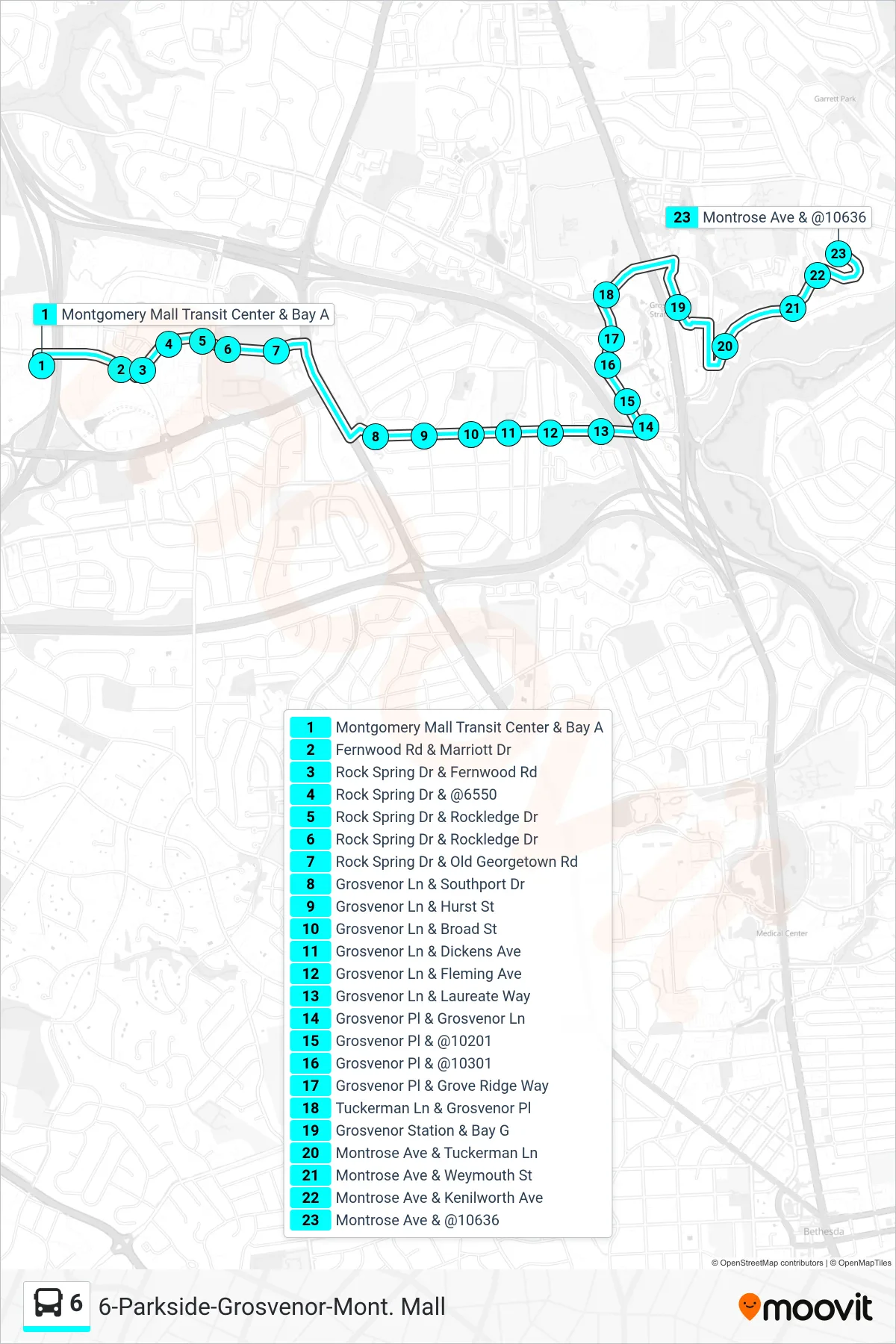
Stops list (6 - Parkside Via Grosvenor)
- Montgomery Mall Transit Center & Bay A
- Fernwood Rd & Marriott Dr
- Rock Spring Dr & Fernwood Rd
- Rock Spring Dr & @6550
- Rock Spring Dr & Rockledge Dr
- Rock Spring Dr & Rockledge Dr
- Rock Spring Dr & Old Georgetown Rd
- Grosvenor Ln & Southport Dr
- Grosvenor Ln & Hurst St
- Grosvenor Ln & Broad St
- Grosvenor Ln & Dickens Ave
- Grosvenor Ln & Fleming Ave
- Grosvenor Ln & Laureate Way
- Grosvenor Pl & Grosvenor Ln
- Grosvenor Pl & @10201
- Grosvenor Pl & @10301
- Grosvenor Pl & Grove Ridge Way
- Tuckerman Ln & Grosvenor Pl
- Grosvenor Station & Bay G
- Montrose Ave & Tuckerman Ln
- Montrose Ave & Weymouth St
- Montrose Ave & Kenilworth Ave
- Montrose Ave & @10636