
60 Bus Route Map
View the 60 route map and see all 60 stops along the route. The map of 60 shows where the bus travels and the location of each stop, making it easy to understand the entire route at a glance.
Explore Rhode Island Public Transit Authority routes on the map and see where Rhode Island Public Transit Authority bus services operate. Use the 60 map to find bus stops and see how the 60 connects different areas along its trip.
All 60 stops on the map are displayed in route order, helping you follow the 60 bus from the first stop to the last.
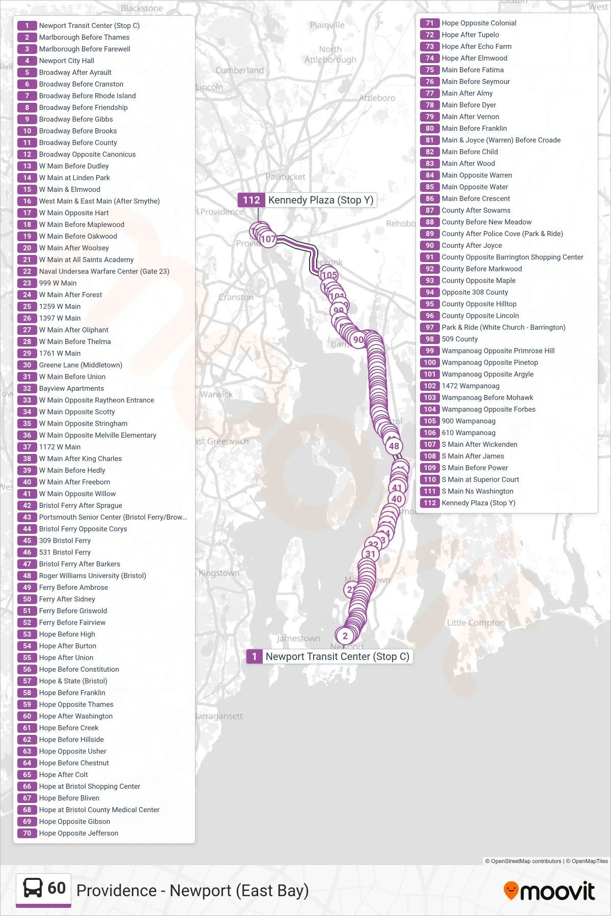
Stops list (60 - Providence Via W Main Rd)
- Newport Transit Center (Stop C)
- Marlborough Before Thames
- Marlborough Before Farewell
- Newport City Hall
- Broadway After Ayrault
- Broadway Before Cranston
- Broadway Before Rhode Island
- Broadway Before Friendship
- Broadway Before Gibbs
- Broadway Before Brooks
- Broadway Before County
- Broadway Opposite Canonicus
- W Main Before Dudley
- W Main at Linden Park
- W Main & Elmwood
- West Main & East Main (After Smythe)
- W Main Opposite Hart
- W Main Before Maplewood
- W Main Before Oakwood
- W Main After Woolsey
- W Main at All Saints Academy
- Naval Undersea Warfare Center (Gate 23)
- 999 W Main
- W Main After Forest
- 1259 W Main
- 1397 W Main
- W Main After Oliphant
- W Main Before Thelma
- 1761 W Main
- Greene Lane (Middletown)
- W Main Before Union
- Bayview Apartments
- W Main Opposite Raytheon Entrance
- W Main Opposite Scotty
- W Main Opposite Stringham
- W Main Opposite Melville Elementary
- 1172 W Main
- W Main After King Charles
- W Main Before Hedly
- W Main After Freeborn
- W Main Opposite Willow
- Bristol Ferry After Sprague
- Portsmouth Senior Center (Bristol Ferry/Brownell)
- Bristol Ferry Opposite Corys
- 309 Bristol Ferry
- 531 Bristol Ferry
- Bristol Ferry After Barkers
- Roger Williams University (Bristol)
- Ferry Before Ambrose
- Ferry After Sidney
- Ferry Before Griswold
- Ferry Before Fairview
- Hope Before High
- Hope After Burton
- Hope After Union
- Hope Before Constitution
- Hope & State (Bristol)
- Hope Before Franklin
- Hope Opposite Thames
- Hope After Washington
- Hope Before Creek
- Hope Before Hillside
- Hope Opposite Usher
- Hope Before Chestnut
- Hope After Colt
- Hope at Bristol Shopping Center
- Hope Before Bliven
- Hope at Bristol County Medical Center
- Hope Opposite Gibson
- Hope Opposite Jefferson
- Hope Opposite Colonial
- Hope After Tupelo
- Hope After Echo Farm
- Hope After Elmwood
- Main Before Fatima
- Main Before Seymour
- Main After Almy
- Main Before Dyer
- Main After Vernon
- Main Before Franklin
- Main & Joyce (Warren) Before Croade
- Main Before Child
- Main After Wood
- Main Opposite Warren
- Main Opposite Water
- Main Before Crescent
- County After Sowams
- County Before New Meadow
- County After Police Cove (Park & Ride)
- County After Joyce
- County Opposite Barrington Shopping Center
- County Before Markwood
- County Opposite Maple
- Opposite 308 County
- County Opposite Hilltop
- County Opposite Lincoln
- Park & Ride (White Church - Barrington)
- 509 County
- Wampanoag Opposite Primrose Hill
- Wampanoag Opposite Pinetop
- Wampanoag Opposite Argyle
- 1472 Wampanoag
- Wampanoag Before Mohawk
- Wampanoag Opposite Forbes
- 900 Wampanoag
- 610 Wampanoag
- S Main After Wickenden
- S Main After James
- S Main Before Power
- S Main at Superior Court
- S Main Ns Washington
- Kennedy Plaza (Stop Y)