
60 Bus Route Map
View the 60 route map and see all 60 stops along the route. The map of 60 shows where the bus travels and the location of each stop, making it easy to understand the entire route at a glance.
Explore Bus Átha Cliath – Dublin Bus routes on the map and see where Bus Átha Cliath – Dublin Bus bus services operate. Use the 60 map to find bus stops and see how the 60 connects different areas along its trip.
All 60 stops on the map are displayed in route order, helping you follow the 60 bus from the first stop to the last.
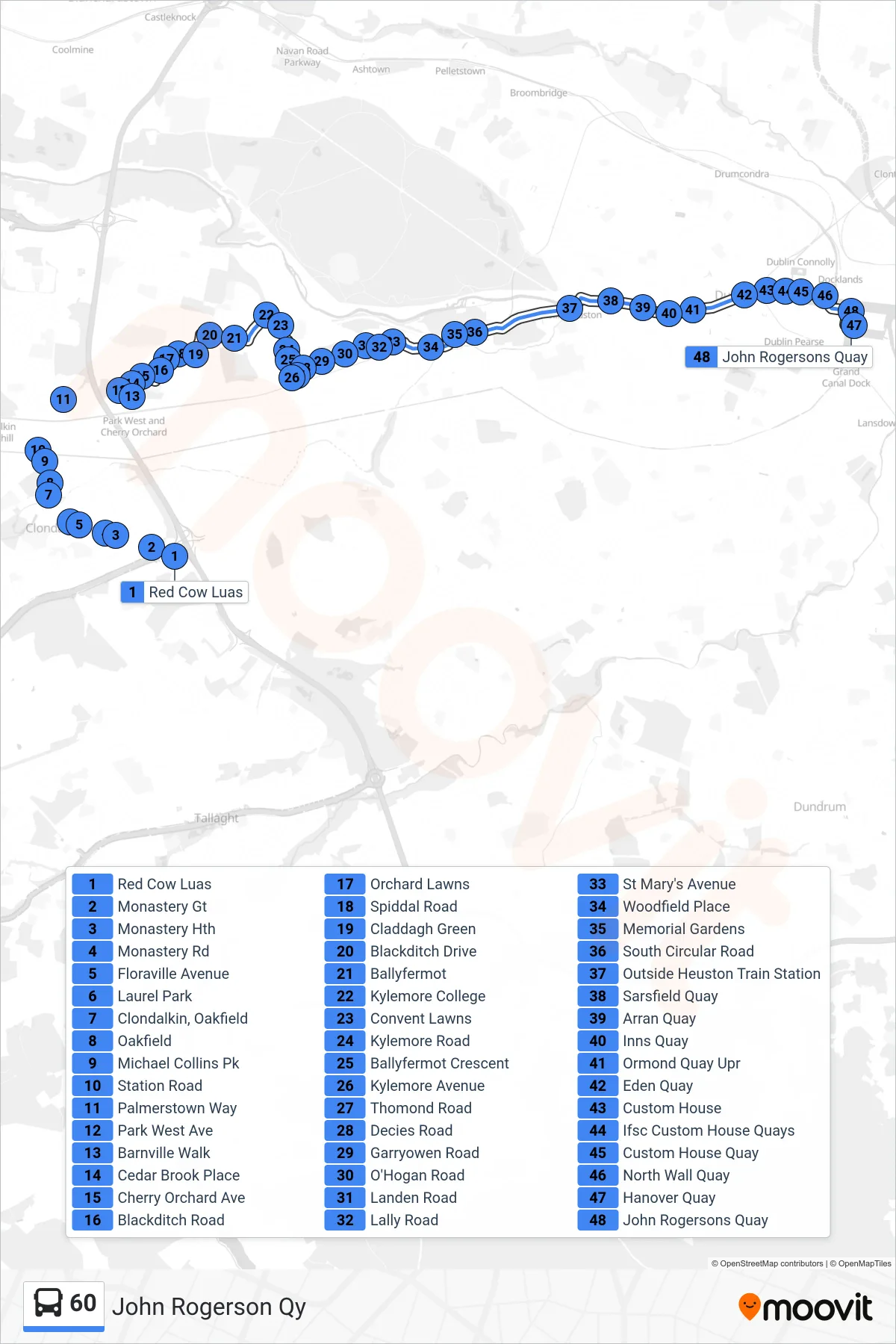
Stops list (60 - John Rogerson Qy)
- Red Cow Luas
- Monastery Gt
- Monastery Hth
- Monastery Rd
- Floraville Avenue
- Laurel Park
- Clondalkin, Oakfield
- Oakfield
- Michael Collins Pk
- Station Road
- Palmerstown Way
- Park West Ave
- Barnville Walk
- Cedar Brook Place
- Cherry Orchard Ave
- Blackditch Road
- Orchard Lawns
- Spiddal Road
- Claddagh Green
- Blackditch Drive
- Ballyfermot
- Kylemore College
- Convent Lawns
- Kylemore Road
- Ballyfermot Crescent
- Kylemore Avenue
- Thomond Road
- Decies Road
- Garryowen Road
- O'Hogan Road
- Landen Road
- Lally Road
- St Mary's Avenue
- Woodfield Place
- Memorial Gardens
- South Circular Road
- Outside Heuston Train Station
- Sarsfield Quay
- Arran Quay
- Inns Quay
- Ormond Quay Upr
- Eden Quay
- Custom House
- Ifsc Custom House Quays
- Custom House Quay
- North Wall Quay
- Hanover Quay
- John Rogersons Quay