
60 Bus Route Map
View the 60 route map and see all 60 stops along the route. The map of 60 shows where the bus travels and the location of each stop, making it easy to understand the entire route at a glance.
Explore Autobuses routes on the map and see where Autobuses bus services operate. Use the 60 map to find bus stops and see how the 60 connects different areas along its trip.
All 60 stops on the map are displayed in route order, helping you follow the 60 bus from the first stop to the last.
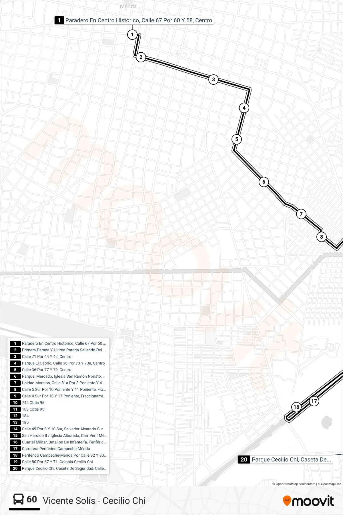
Stops list (60 - Vicente Solís - Cecilio Chí)
- Paradero En Centro Histórico, Calle 67 Por 60 Y 58, Centro
- Primera Parada Y Ultima Parada Saliendo Del Centro Histórico, Calle 71 Por 58 Y 56, Centro
- Calle 71 Por 44 Y 42, Centro
- Parque El Cabrío, Calle 36 Por 73 Y 73a, Centro
- Calle 36 Por 77 Y 79, Centro
- Parque, Mercado, Iglesia San Ramón Nonato, Calle 81a Por 30b Y 30a, San Jose
- Unidad Morelos, Calle 81a Por 3 Poniente Y 4 Poniente, Fraccionamiento Unidad Morelos
- Calle 5 Sur Por 10 Poniente Y 11 Poniente, Fraccionamiento Unidad Morelos
- Calle 4 Sur Por 16 Y 17 Poniente, Fraccionamiento Unidad Morelos
- 742 Cbtis 95
- 183 Cbtis 95
- 184
- 185
- Calle 49 Por 8 Y 10 Sur, Salvador Alvarado Sur
- San Haroldo II / Iglesia Alborada, Carr Perif Mérida-Campeche X C 49 Y 41
- Cuartel Militar, Batallón De Infantería, Periférico Mérida-Campeche
- Carretera Periférico Campeche-Mérida
- Periférico Campeche-Mérida Por Calle 82 Y 80, Cecilio Chí
- Calle 80 Por 67 Y 71, Colonia Cecilio Chi
- Parque Cecilio Chi, Caseta De Seguridad, Calle 79 Por 80 Y 78, Cecilio Chi