
60 Bus Route Map
View the 60 route map and see all 60 stops along the route. The map of 60 shows where the bus travels and the location of each stop, making it easy to understand the entire route at a glance.
Explore KSRTC Ordinary Bus Services routes on the map and see where KSRTC Ordinary Bus Services bus services operate. Use the 60 map to find bus stops and see how the 60 connects different areas along its trip.
All 60 stops on the map are displayed in route order, helping you follow the 60 bus from the first stop to the last.
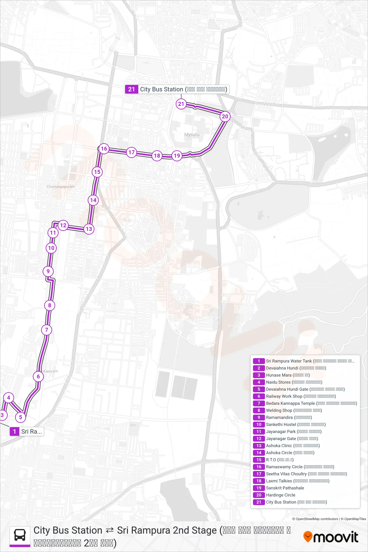
Stops list (60 - → City Bus Station (ನಗರ ಬಸ್ ನಿಲ್ದಾಣ))
- Sri Rampura Water Tank (ಶ್ರೀ ರಾಮ್ಪುರ ವಾಟರ್ ಟ್ಯಾಂಕ್)
- Devaiahna Hundi (ದೇವಯ್ಯನ ಹುಂಡಿ)
- Hunase Mara (ಹುಣಸೇ ಮರ)
- Naidu Stores (ನಾಯ್ಡು ಸ್ಟೋರ್ಸ್)
- Devaiahna Hundi Gate (ದೇವಯ್ಯನ ಹುಂಡಿ ಗೇಟ್)
- Railway Work Shop (ರೈಲ್ವೇ ವರ್ಕ್ಶಾಪ್)
- Bedara Kannappa Temple (ಬೇಡರ ಕಣ್ಣಪ್ಪ ದೇವಸ್ಥಾನ)
- Welding Shop (ವೆಲ್ಡಿಂಗ್ ಶಾಪ್)
- Ramamandira (ರಾಮಮಂದಿರ)
- Sankethi Hostel (ಸಂಕೇತಿ ಹಾಸ್ಟಲ್)
- Jayanagar Park (ಜಯನಗರ ಪಾರ್ಕ್)
- Jayanagar Gate (ಜಯನಗರ ಗೇಟ್)
- Ashoka Clinic (ಅಶೋಕ ಕ್ಲಿನಿಕ್)
- Ashoka Circle (ಅಶೋಕ ವೃತ್ತ)
- R.T.O (ಆರ್.ಟಿ.ಓ)
- Ramaswamy Circle (ರಾಮಸ್ವಾಮಿ ವೃತ್ತ)
- Seetha Vilas Choultry (ಸೀತಾ ವಿಲಾಸ್ ಚೌಲ್ಟ್ರಿ)
- Laxmi Talkies (ಲಕ್ಷ್ಮೀ ಚಿತ್ರಮಂದಿರ)
- Sanskrit Pathashale
- Hardinge Circle
- City Bus Station (ನಗರ ಬಸ್ ನಿಲ್ದಾಣ)