
60 Bus Route Map
View the 60 route map and see all 60 stops along the route. The map of 60 shows where the bus travels and the location of each stop, making it easy to understand the entire route at a glance.
Explore NC State University Wolfline routes on the map and see where NC State University Wolfline bus services operate. Use the 60 map to find bus stops and see how the 60 connects different areas along its trip.
All 60 stops on the map are displayed in route order, helping you follow the 60 bus from the first stop to the last.
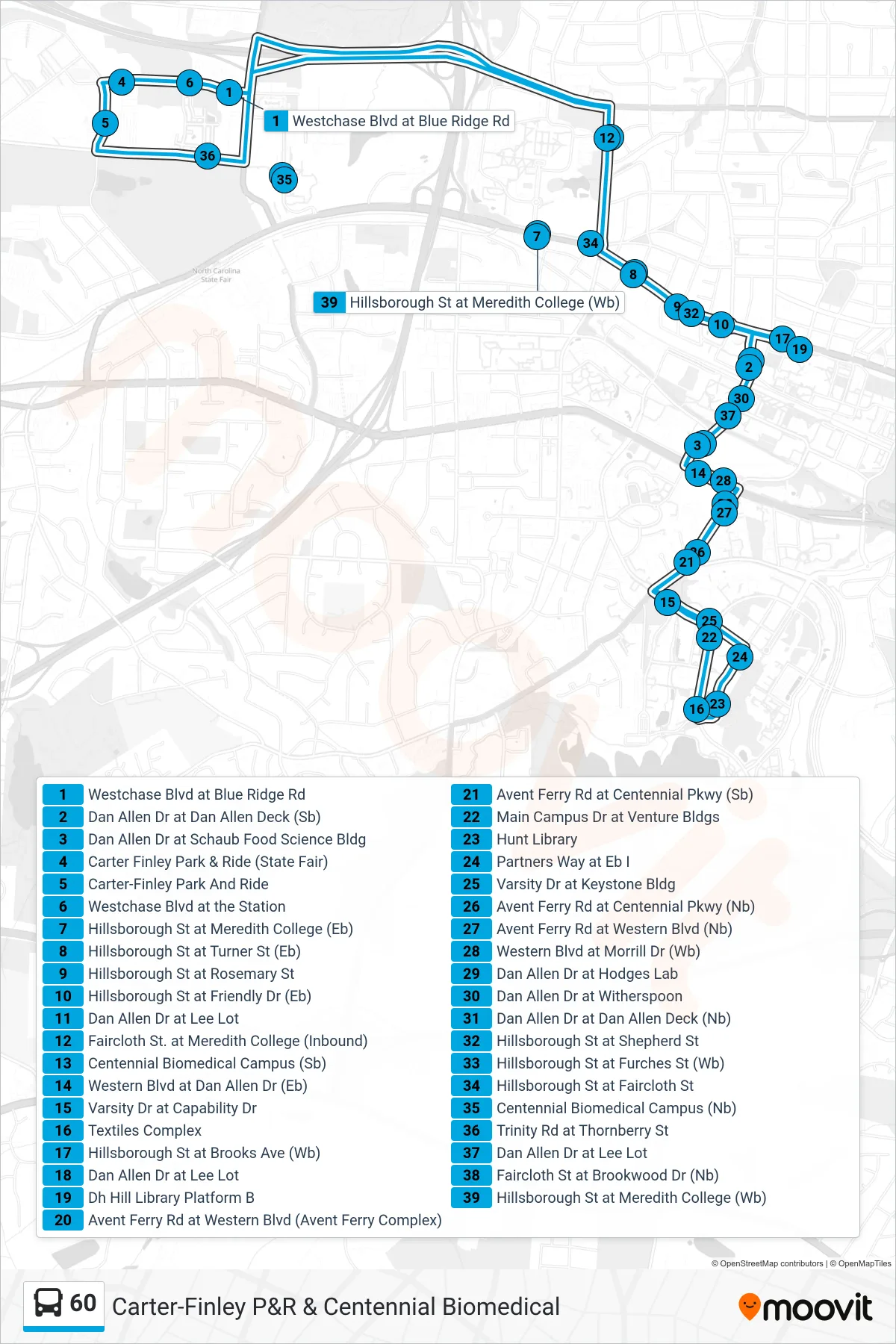

Stops list (60 - Route 60)
- Carter-Finley Park And Ride
- Westchase Blvd at the Station
- Westchase Blvd at Blue Ridge Rd
- Centennial Biomedical Campus (Sb)
- Hillsborough St at Meredith College (Eb)
- Hillsborough St at Turner St (Eb)
- Hillsborough St at Rosemary St
- Hillsborough St at Friendly Dr (Eb)
- Dan Allen Dr at Dan Allen Deck (Sb)
- Dan Allen Dr at Lee Lot
- Dan Allen Dr at Schaub Food Science Bldg
- Western Blvd at Dan Allen Dr (Eb)
- Avent Ferry Rd at Western Blvd (Avent Ferry Complex)
- Avent Ferry Rd at Centennial Pkwy (Sb)
- Varsity Dr at Capability Dr
- Main Campus Dr at Venture Bldgs
- Main Campus Dr at Research Dr
- Textiles Complex
- Hunt Library
- Partners Way at Eb I
- Varsity Dr at Keystone Bldg
- Avent Ferry Rd at Centennial Pkwy (Nb)
- Avent Ferry Rd at Western Blvd (Nb)
- Western Blvd at Morrill Dr (Wb)
- Dan Allen Dr at Hodges Lab
- Dan Allen Dr at Witherspoon
- Dan Allen Dr at Dan Allen Deck (Nb)
- Hillsborough St at Shepherd St
- Hillsborough St at Furches St (Wb)
- Hillsborough St at Faircloth St
- Hillsborough St at Meredith College (Wb)
- Centennial Biomedical Campus (Nb)
- Trinity Rd at Thornberry St
- Carter-Finley Park And Ride