
60 Bus Route Map
View the 60 route map and see all 60 stops along the route. The map of 60 shows where the bus travels and the location of each stop, making it easy to understand the entire route at a glance.
Explore Rogue Valley Transportation District routes on the map and see where Rogue Valley Transportation District bus services operate. Use the 60 map to find bus stops and see how the 60 connects different areas along its trip.
All 60 stops on the map are displayed in route order, helping you follow the 60 bus from the first stop to the last.
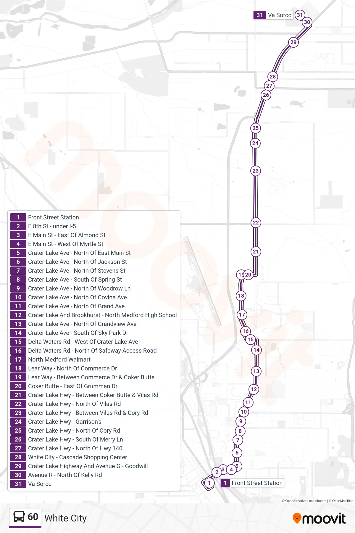
Stops list (60 - White City)
- Front Street Station
- E 8th St - under I-5
- E Main St - East Of Almond St
- E Main St - West Of Myrtle St
- Crater Lake Ave - North Of East Main St
- Crater Lake Ave - North Of Jackson St
- Crater Lake Ave - North Of Stevens St
- Crater Lake Ave - South Of Spring St
- Crater Lake Ave - North Of Woodrow Ln
- Crater Lake Ave - North Of Covina Ave
- Crater Lake Ave - North Of Grand Ave
- Crater Lake And Brookhurst - North Medford High School
- Crater Lake Ave - North Of Grandview Ave
- Crater Lake Ave - South Of Sky Park Dr
- Delta Waters Rd - West Of Crater Lake Ave
- Delta Waters Rd - North Of Safeway Access Road
- North Medford Walmart
- Lear Way - North Of Commerce Dr
- Lear Way - Between Commerce Dr & Coker Butte
- Coker Butte - East Of Grumman Dr
- Crater Lake Hwy - Between Coker Butte & Vilas Rd
- Crater Lake Hwy - North Of Vilas Rd
- Crater Lake Hwy - Between Vilas Rd & Cory Rd
- Crater Lake Hwy - Garrison's
- Crater Lake Hwy - North Of Cory Rd
- Crater Lake Hwy - South Of Merry Ln
- Crater Lake Hwy - North Of Hwy 140
- White City - Cascade Shopping Center
- Crater Lake Highway And Avenue G - Goodwill
- Avenue R - North Of Kelly Rd
- Va Sorcc