
60 Bus Route Map
View the 60 route map and see all 60 stops along the route. The map of 60 shows where the bus travels and the location of each stop, making it easy to understand the entire route at a glance.
Explore AC Transit routes on the map and see where AC Transit bus services operate. Use the 60 map to find bus stops and see how the 60 connects different areas along its trip.
All 60 stops on the map are displayed in route order, helping you follow the 60 bus from the first stop to the last.
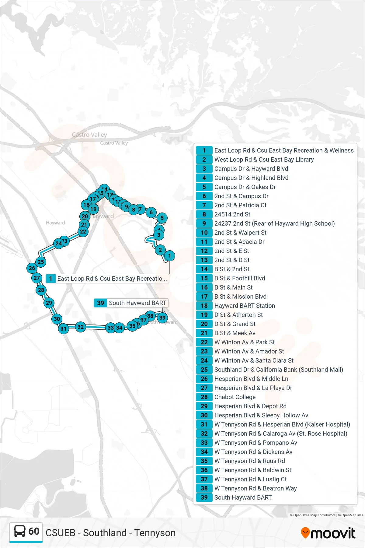
Stops list (60 - South Hayward BART)
- East Loop Rd & Csu East Bay Recreation & Wellness
- West Loop Rd & Csu East Bay Library
- Campus Dr & Hayward Blvd
- Campus Dr & Highland Blvd
- Campus Dr & Oakes Dr
- 2nd St & Campus Dr
- 2nd St & Patricia Ct
- 24514 2nd St
- 24237 2nd St (Rear of Hayward High School)
- 2nd St & Walpert St
- 2nd St & Acacia Dr
- 2nd St & E St
- 2nd St & D St
- B St & 2nd St
- B St & Foothill Blvd
- B St & Main St
- B St & Mission Blvd
- Hayward BART Station
- D St & Atherton St
- D St & Grand St
- D St & Meek Av
- W Winton Av & Park St
- W Winton Av & Amador St
- W Winton Av & Santa Clara St
- Southland Dr & California Bank (Southland Mall)
- Hesperian Blvd & Middle Ln
- Hesperian Blvd & La Playa Dr
- Chabot College
- Hesperian Blvd & Depot Rd
- Hesperian Blvd & Sleepy Hollow Av
- W Tennyson Rd & Hesperian Blvd (Kaiser Hospital)
- W Tennyson Rd & Calaroga Av (St. Rose Hospital)
- W Tennyson Rd & Pompano Av
- W Tennyson Rd & Dickens Av
- W Tennyson Rd & Ruus Rd
- W Tennyson Rd & Baldwin St
- W Tennyson Rd & Lustig Ct
- W Tennyson Rd & Beatron Way
- South Hayward BART